Colombia is located in the northwest of South America. It is bordered to the northwest by Panama; to the east by Venezuela and Brazil; to the south by Ecuador and Peru. It shares maritime limits with Costa Rica, Nicaragua, Honduras, Jamaica, the Dominican Republic, and Haiti.
Colombia has a land size of 1,141,748 km2 (440,831 sq mi) and it is the 25th largest nation in the world and the fourth-largest country in South America (after Brazil, Argentina, and Peru).
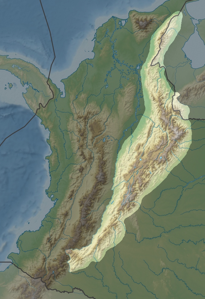
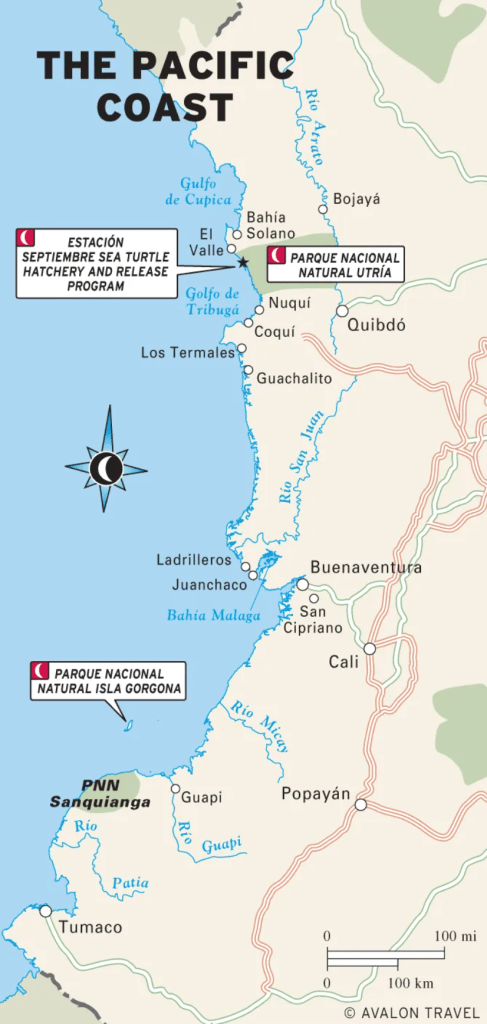
Colombia can be divided into six distinct natural regions: the Andean Region, covering the three branches of the Andes mountains found in Colombia; the Caribbean Region, covering the area adjacent to the Caribbean Sea; the Insular Region, comprising the islands in both the Atlantic and Pacific Oceans, the Pacific Region adjacent to the Pacific Ocean, the Orinoquía Region, part of the Llanos plains mainly in the Orinoco river basin and finally, the Amazon Region, part of the Amazon rainforest. See the map below:
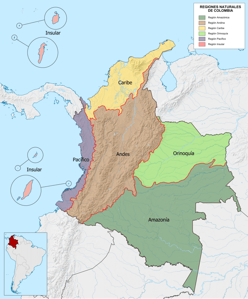
The Andean Region
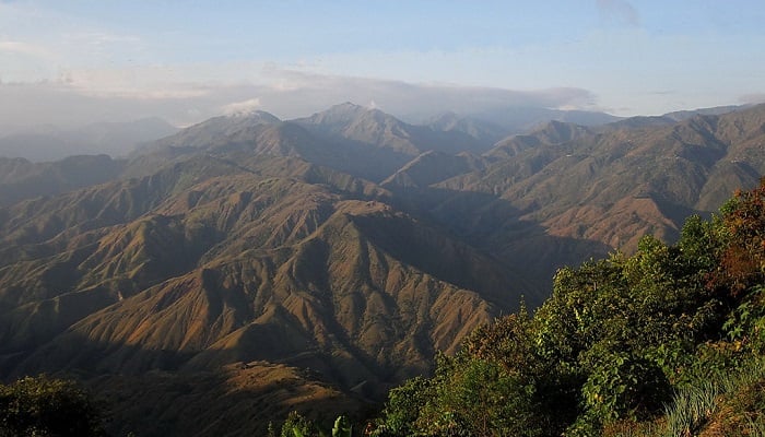
The Andes mountains form the most populous region of Colombia and contain the majority of the country’s urban centers. In the 1980’s about 78 percent of the country’s population lived in this area. Near the Ecuadorian frontier, the Andes Mountains divide into three distinct, roughly parallel chains, called cordilleras, that extend northeastward almost to the Caribbean Sea.
There are three Andean mountain ranges in Colombia. They are cordillera occidental, cordillera central and cordillera oriental.
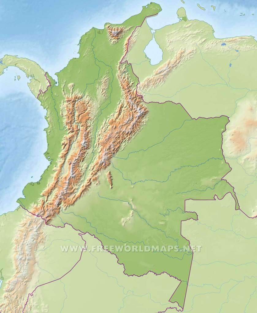
Altitudes reach more than 18,700 ft (5,700 m), and mountain peaks are permanently covered with snow. The elevated basins and plateaus of these ranges have a moderate climate that provides pleasant living conditions and in many places enables farmers to harvest twice a year. Torrential rivers on the slopes of the mountains produce a large hydroelectric power potential and add their volume to the navigable rivers in the valleys.
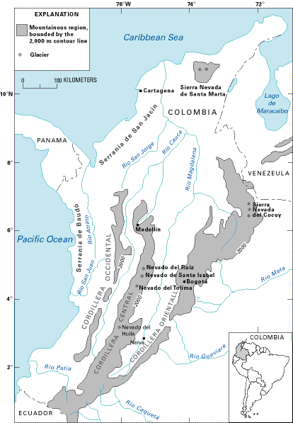
The Cordillera Occidental is relatively low and is the least populated of the three cordilleras. Summits are only about 9,840 ft (2,999 m) above sea level and do not have permanent snows. Few passes exist, although one that is about 4,985 ft (1,519 m) above sea level provides the major city of Cali with an outlet to the Pacific Ocean. The relatively low elevation of the cordillera permits dense vegetation, which on the western slopes is truly tropical.


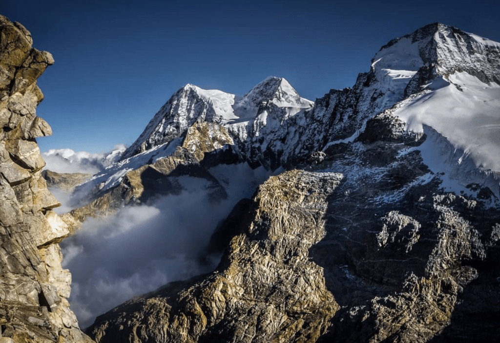
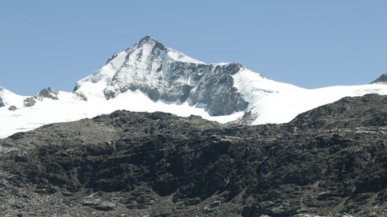
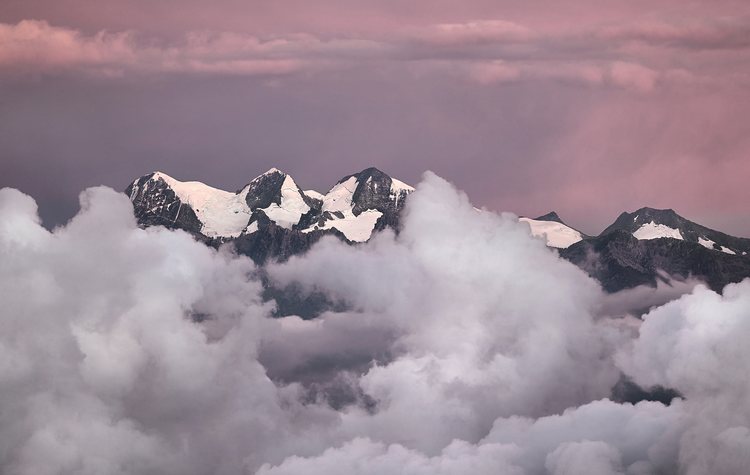
The Cordillera Central is the highest of the mountain systems. Its crystalline rocks form a towering wall dotted with snow-covered volcanoes that is 500 mi (805 km) long. There are no plateaus in this range and no passes under 10,825 ft (3,299 m). The highest peak in this range, the Nevado del Huila, is the highest volcano peak in Colombia and reaches 17,602 ft (5,365 m) above sea level.
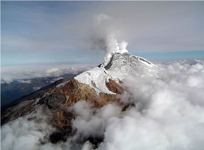
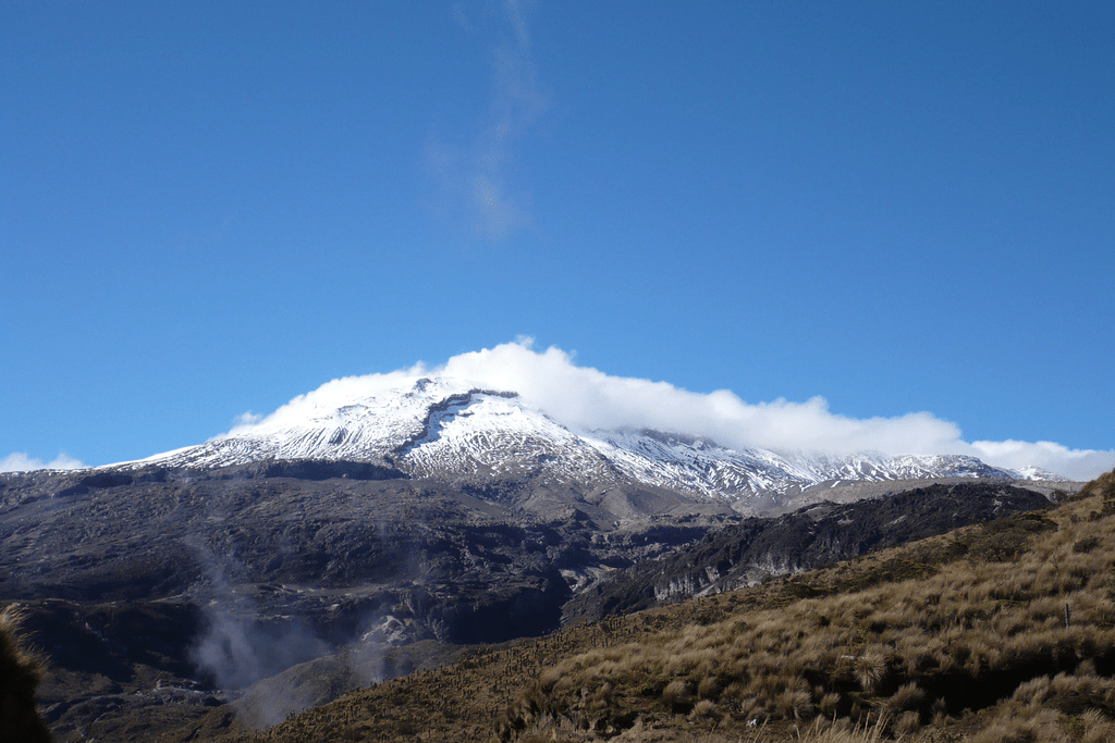
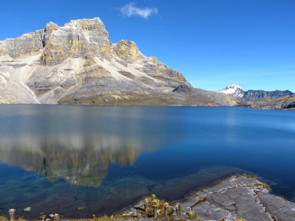
Nevado del Ruiz. Wikimedia Commons. Cr. Edgar
Click HERE to take a look around this area of “Los Nevados” in Google Maps. ^ ^ So beautiful!


The Cordillera Oriental
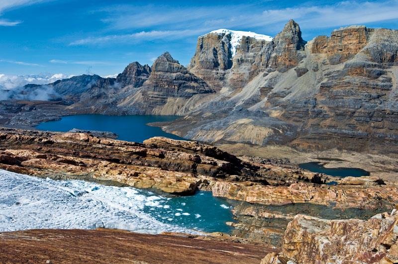
The Cordillera Oriental is the widest of the three branches of the Colombian Andes. The range extends from south to north culminating in the towering Mount Cocuy (Sierra Nevada del Cocuy), which rises to 18,022 feet (5,493 metres). Beyond this point, near Pamplona, the cordillera splits into two much narrower ranges, one extending into Venezuela, the other, the Perijá Mountains, forming the northern boundary range between Colombia and Venezuela. The Perijás then descend northward toward the Caribbean to the arid La Guajira Peninsula, the northernmost extension of the Colombian mainland.
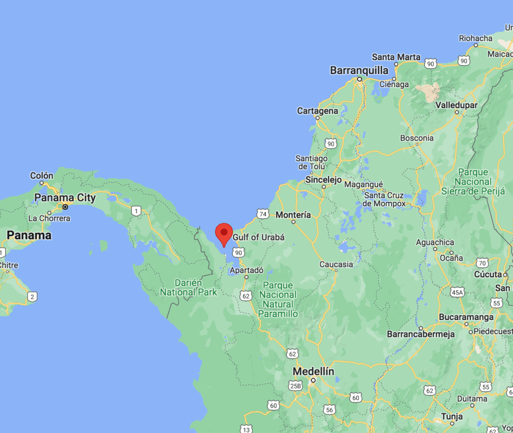
The Caribbean Region
The Caribbean lowlands consist of all of Colombia north of an imaginary line extending northeastward from the Golfo de Urabá to the Venezuelan frontier at the northern extremity of the Cordillera Oriental. The semiarid Guajira Peninsula and Guajira–Barranquilla xeric scrub, in the extreme north, bear little resemblance to the rest of the region.
This is the Gulf of Urabá:
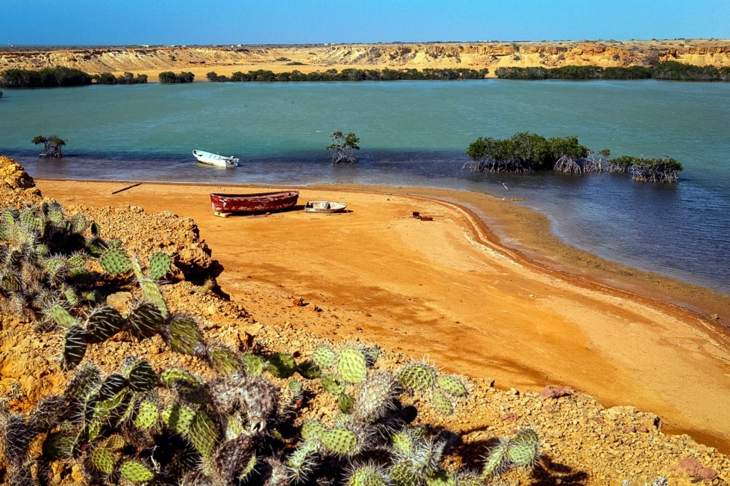
Going to the opposite side (next to Venezuela) you find “La Guajira.” It is a very dry desert like area with cacti! It is one of the areas where indigenous people live. The color of the sand is so bright!

In the southern part rises the Sierra Nevada de Santa Marta, an isolated mountain system where the highest mountains of Colombia are. They are an impressive granitic massif that ascends abruptly from the Caribbean littoral to snow- and ice-covered summits. They rise to 18,947 feet (5,775 metres)! at the “twin peaks” of Cristóbal Colón and Simón Bolívar, the highest point in the country. There is a still an ongoing discussion about which mountain is higher, so some literature says it’s the Cristóbal Colón one and some say it’s Pico Simón Bolivar and then some say they are the same height hense the twin peak reference. To take you pick for the peak! ^ ^
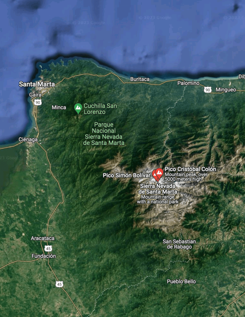
And this is a general view of the Sierra Nevada de Santa Marta:
This Caribbean region merges next to and is connected with the Andean highlands through the two great river valleys. After the Andean highlands, it is the second-most important region in terms of economic activity. Approximately 17% of the country’s population lived in this region in the late 1980s.
Most of the country’s commerce moves through the cities of Cartagena, Barranquilla, Santa Marta, and the other ports located along this important coast. Inland from these cities are swamps, hidden streams, and shallow lakes that support banana and cotton plantations for major commodity crops, countless small farms, and, in higher places, cattle ranches. Cartagena, in reality ‘Cartagena de Indias’ is the most visited city in Colombia. I will dedicate a post to this city very soon! ^ ^
The Insular Region
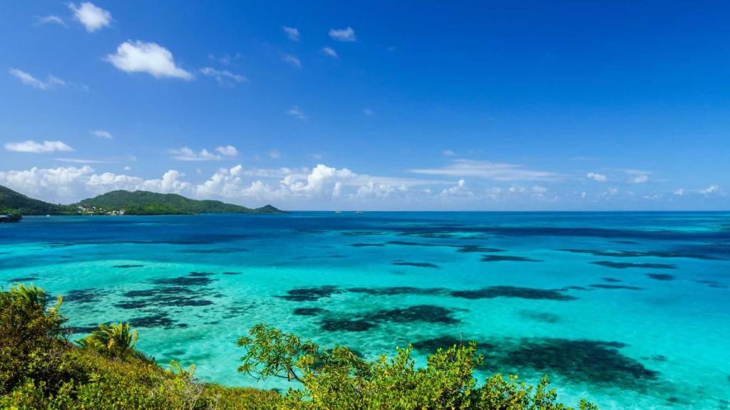
The Insular Region comprises the areas outside the continental territories of Colombia and includes the San Andrés y Providencia Department in the Caribbean sea and the Malpelo and Gorgona islands in the Pacific Ocean. Its subregions include other groups of islands:
- Archipiélago de San Bernardo (in the Morrosquillo Gulf, Caribbean).
- Islas del Rosario (Caribbean)
- Isla Fuerte (Caribbean)
- Isla Barú (Caribbean)
- Isla Tortuguilla (Caribbean)
- Isla Tierra Bomba (Caribbean)
The Archipelago of San Andrés, Providencia and Santa Catalina or San Andrés and Providencia, is one of the departments of Colombia, and the only one in North America. It consists of two island groups in the Caribbean Sea about 775 km (482 mi) northwest of mainland Colombia, and eight outlying banks and reefs. The largest island of the archipelago and Colombia is called San Andrés and its capital is San Andrés. The other large islands are Providencia and Santa Catalina Islands which lie to the north-east of San Andrés; their capital is Santa Isabel.


This is a video about San Andres:
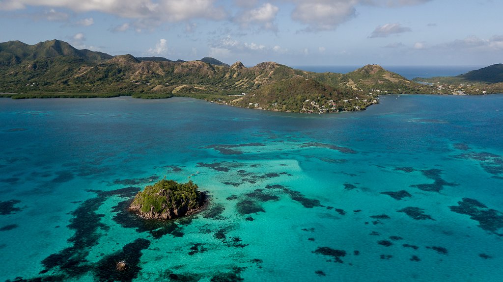
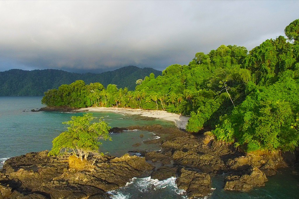
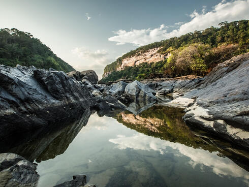
The Pacific Region
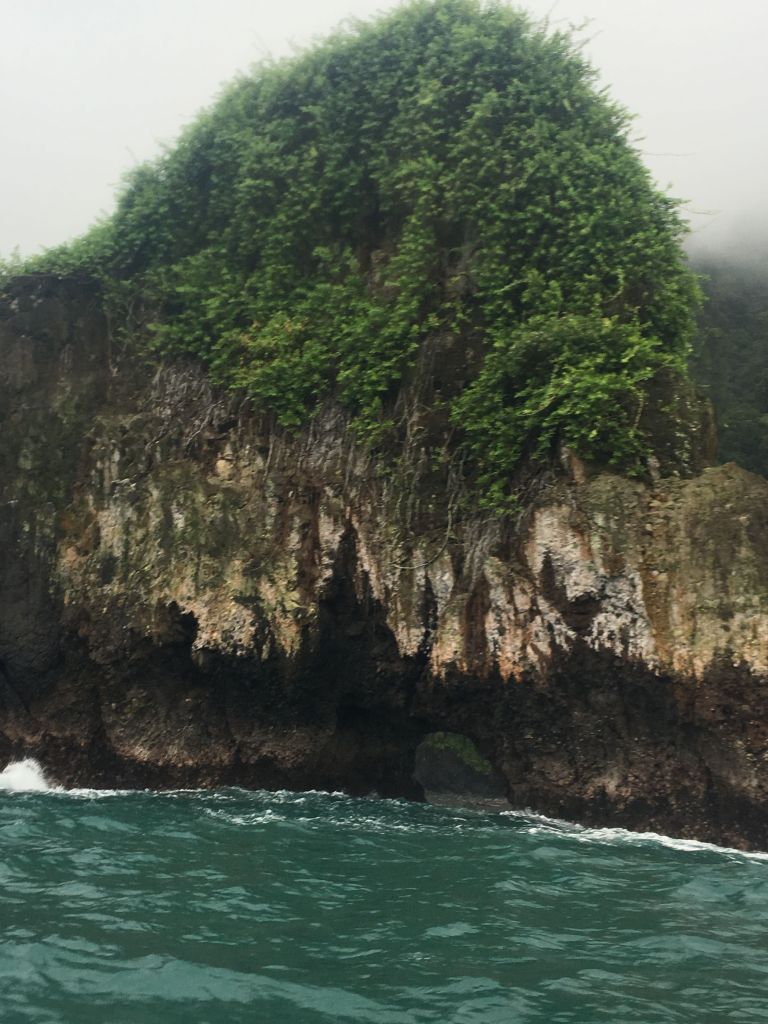
In this region there are the very narrow and discontinuous Pacific coastal lowlands, which are backed by the Serranía de Baudó, the lowest and narrowest of Colombia’s mountain ranges. The Serranía del Baudó is separated from the West Andes by the Atrato valley where the Atrato River flows and Quibdó is located. From the south the range extends from the Baudó River north and slightly west along the coast into Panama terminating at the Golfo de San Miguel. The range is called Serranía del Sapo when it is in Panama. Technically the landform extends south of the Baudó River down to Malaga Bay, but the area has been eroded into low hills and marshlands. (1)
Here are some photos from all over this region:

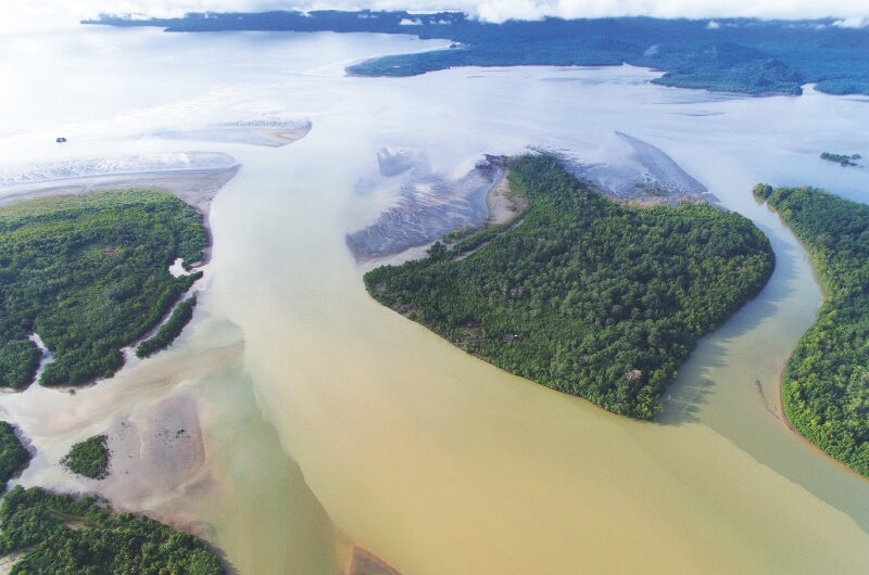
From Cabo Corrientes north to Punta Ardita and on into Panama the Baudó Mountains meet the ocean in steep cliffs, rising up to as high as 70 m (230 ft), with small indentations in the coast providing small pocket beaches, some sandy, but most are shingle or cobble. However, near river mouths the coast has been eroded and there are wide sandy beaches, tidal flats and even mangrove swamps.

For an incredible 360 view of the last photo view go HERE and then check HERE.
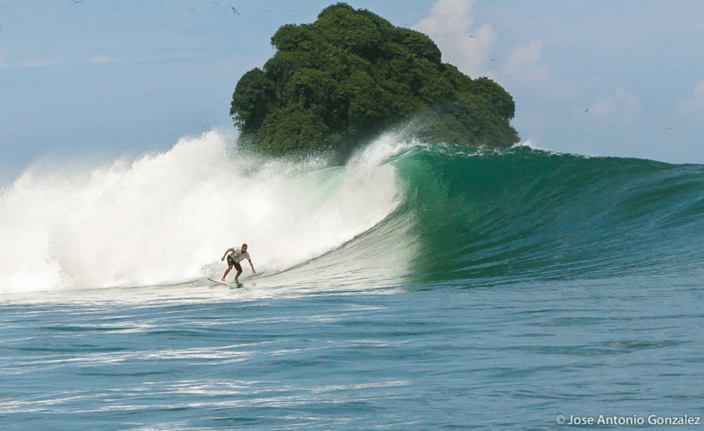
Yes… there you can catch amazing waves as a surfer or windsurfer… imagine that you can even hang out with whales as you do it!
Orinoquía Region
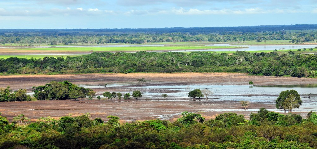
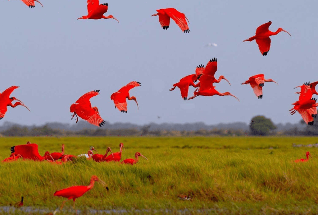
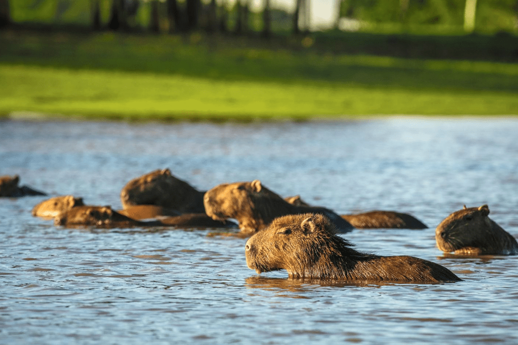
This area is located to the east of the Andes region and includes about 699,300 square kilometers or three-fifths of the country’s total area. The entire area, known as “Los Llanos” or eastern plains in English, was home to only two percent of the country’s population in the late 1980s. This term of “los Llanos” can only be applied only to the open plains in the northern part, particularly the Piedmont areas near the Cordillera Oriental, where extensive cattle raising is practiced.
Orinoquia is a rarity in our world, an extense natural land rich in biodiversity, untouched by humans. Sadly as Colombia is recovering from years of violence, the government has set its eyes in developing this land. ” The 2016 peace accord has spurred billions of dollars in investments to propel such growth. Although plans are still taking shape, up to 14 million hectares—more than half of the region—could be converted into large-scale or intensified agriculture, mostly soybean and palm oil production as well as cattle.” (2)
This is a map of the region:
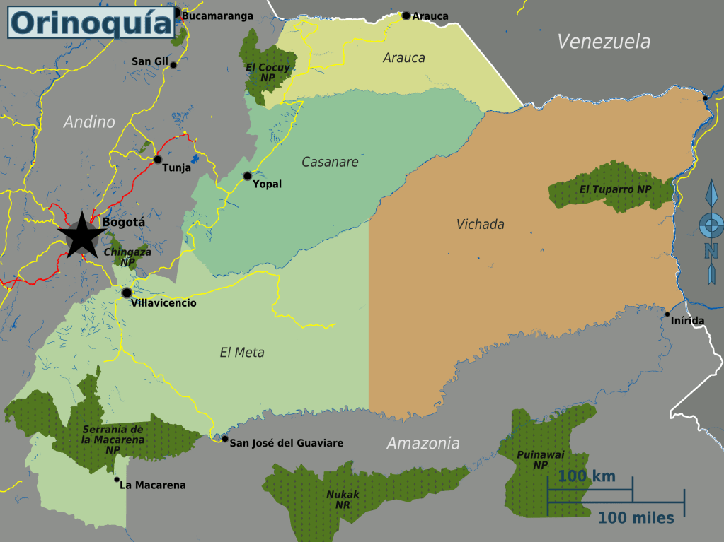
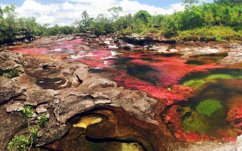
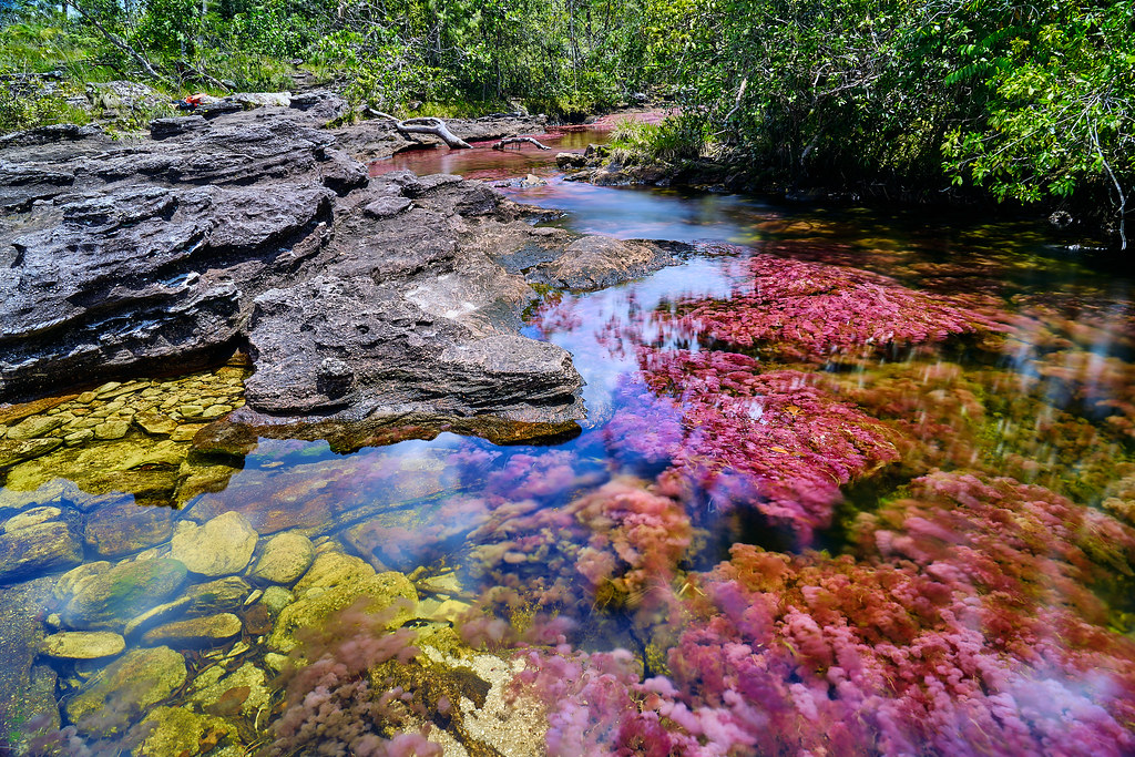
Of all these subregions in Orinoquía, El Meta is the area that is currently most developed as it is near the capital Bogotá. The main attraction here are the haciendas for rent around Villavicencio, which are wildly and rightly popular with Bogotanos looking to escape their high-altitude, colder climate for a weekend or week. The rentals are cheap, and the houses/farms are beautiful, generally with pools in the courtyards. A great escape! This region is largely unknown to international travelers, and most guidebooks to Colombia don’t even mention it.
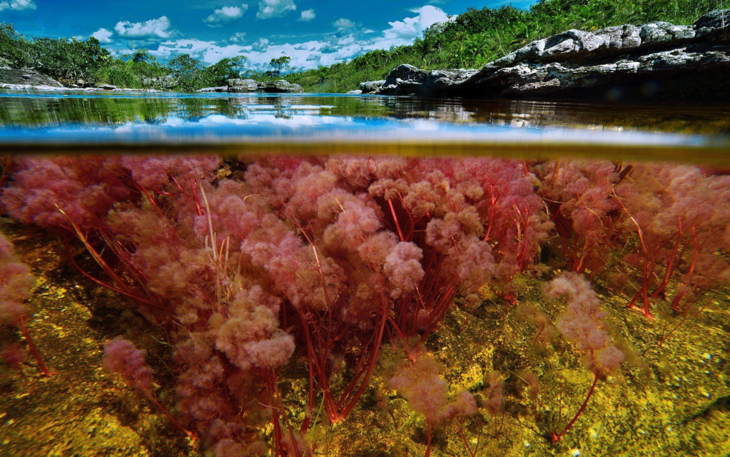
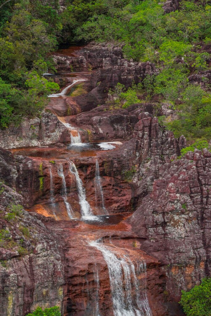
The most amazing sight in El Meta, and really one of the most amazing sights in all South America, is Caño Cristales, a.k.a. the River of seven colors, a.k.a the most beautiful river in the world. In the period of the year between the rainy and dry seasons, the algae of this always beautiful river turn bright red, leading to an explosion of colors.

And can this possibly get any more beautiful? Well as we are talking about South America it can, and it does. There is no word to even begin to describe the beauty, richness and grandiosity of the next region:
The Amazon Region
The Amazon region covers about 35% of Colombia’s territory. It is about 186,487square miles (483,000 km²). It includes the departments of Amazonas, Caquetá, Guainía, Guaviare, Putumayo and Vaupés.
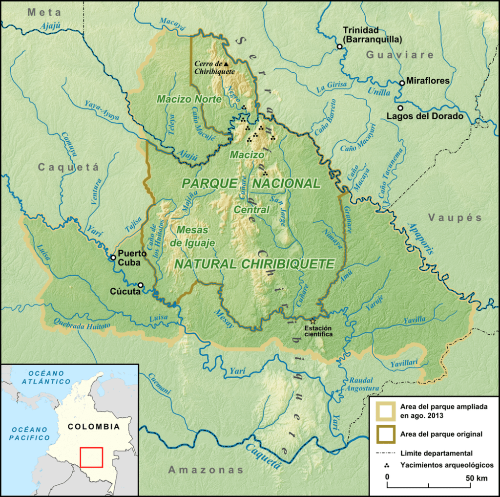
One thing that called my attention in the Amazon Department was the largest national park of Colombia and the largest rainforest national par in the world: Chiribiquete National Park. It is around 17,000 square miles and declared a World Heritage Site in 2018. To give you a better idea of the immensity of this place, this park alone is as big as Switzerland.
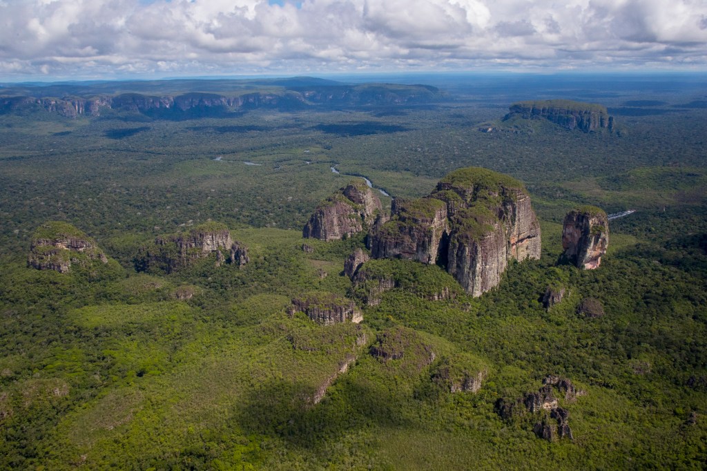
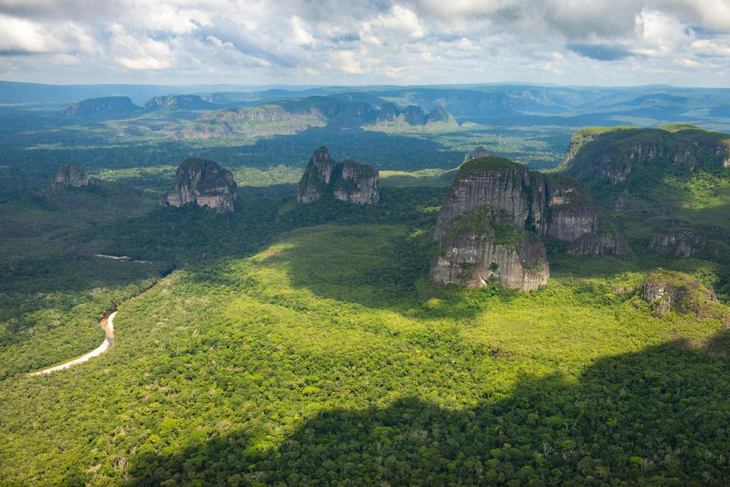
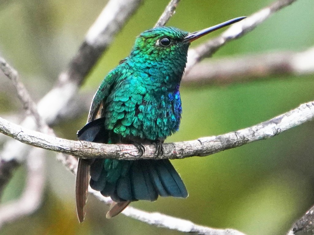
Chiribiquete National Park is made of isolated table mountains that are part of the western edge of the Guiana Shield. The Guiana Shield It is a 1.7 billion-year-old Precambrian geological formation in northeast South America that forms a portion of the northern coast. The higher elevations on the shield are called the Guiana Highlands, which is where the table-like mountains called ‘Tepuis’ are found. It is one of the few places where the fauna and flora of the Guiana Shield, Orinoco savannas, the Andes and the Amazon rainforest converge. This leads to incredible biodiversity in the pristine and remote rainforest with Tepuis that reach up to 1,000 meters in height.
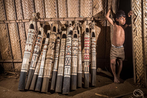
The area is largely unexplored which makes it one of the most important wilderness areas in the world. According to the government of Colombia it has 70% of the mammals, 35% of the birds, 51% of the reptiles, 40% of anfibians and 70% of fish of Colombia! (3) Furthermore, the presence of indigenous groups still living in isolation in this area makes Chiribiquete also a cultural heritage that was recognized by UNESCO as a mixed World Heritage site.

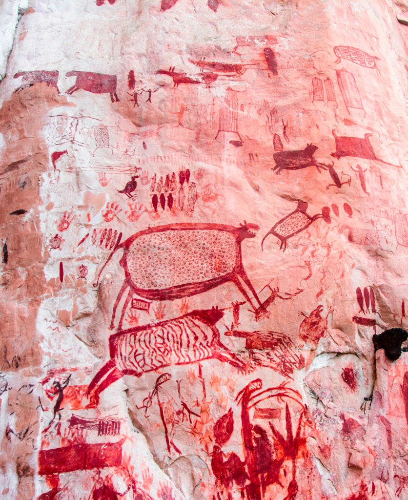
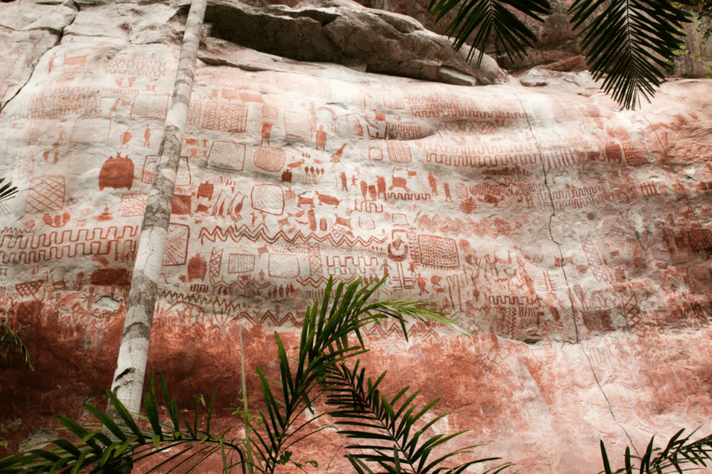
And this incredible place also hosts important archaeological evidence in the form of rock art. More than 600,000 traces of around 75,000 petroglyphs and pictographs have been discovered in the mountain chain!!! The oldest of which may date to 20,000 years. The rock art has been produced until the 16th century CE. The rock paintings were first recorded by the American botanist Richard Evans Schultes in the 1940s. Later investigations were carried out by Thomas van der Hammen.
As much as I would love to see such a beautiful place, I’m happy to write that as a visitor one can only fly over it
Last thing I will share with you is something I read about this place that left me further in awe. This park’s land mass helps to keep 323 million tons of carbon from escaping into the atmosphere. Imagine that?! And this is only a tiny piece of the entire Amazon that has 2.1 million square miles. The Amazon is the lung of the world… we all must do our part to preserve it…
I feel so tiny…! ^ ^
CREDITS
(1) Wikipedia. Geography of Colombia
(2) The Nature Conservancy. Article: The World’s Eyes Are Watching Colombia’s Orinoquia.
(3) Conde Nast Traveler: Abre el Parque Nacional de Chiribiquete, la joya oculta de Colombia
