In the 1500s, the Spanish understanding of Peruvian geography through the eyes of early chroniclers like Pedro Cieza de León and later José de Acosta was shaped by the “traditional compendium” of the Three Natural Regions: La Costa, La Sierra, and La Selva. I think this version is great for younger students to learn especially between Kindergarten and Third Grade.
The traditional way to classify the natural geographical regions of Peru is three: La Costa, La Sierra and La Selva. Ready to take an incredible trip of contrasts and adventure? Let’s go to Peru!
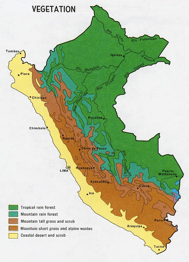
1. La Costa
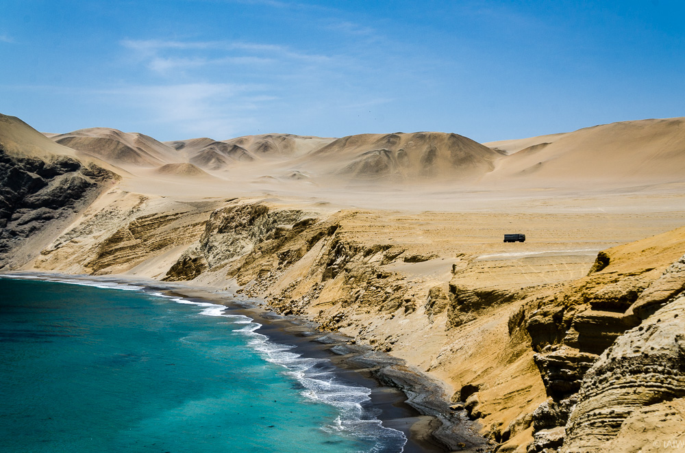
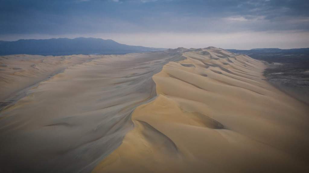
The Chala, or Coast, is the first of Peru’s first natural region, stretching from the Pacific shoreline up to an elevation of 500 meters. This narrow, arid strip is defined by a unique climate where the cold Humboldt Current creates a persistent sea mist called garúa. This mist prevents rain but provides enough moisture to support “fog gardens” known as Lomas on the hillsides. Temperatures remain remarkably mild, generally oscillating between 59˚F (15°C) and 80˚F (27°C), preventing the extreme heat usually associated with such latitudes.
The landscape remains a stark contrast of vast, wind-sculpted sand dunes interrupted by more than fifty fertile river valleys, which act as green oases where most of the region’s agriculture and urban centers are concentrated.
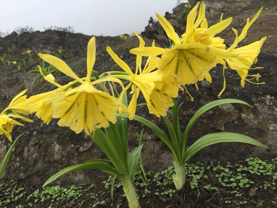
In these seasonal ecosystems, the yellow Amancaes flower, wild tomatoes, and tara trees flourish despite the surrounding desert.
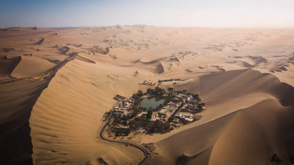
Nazca and Huacachina, into the desert of Peru. Cr. Uncharted backpacker. com
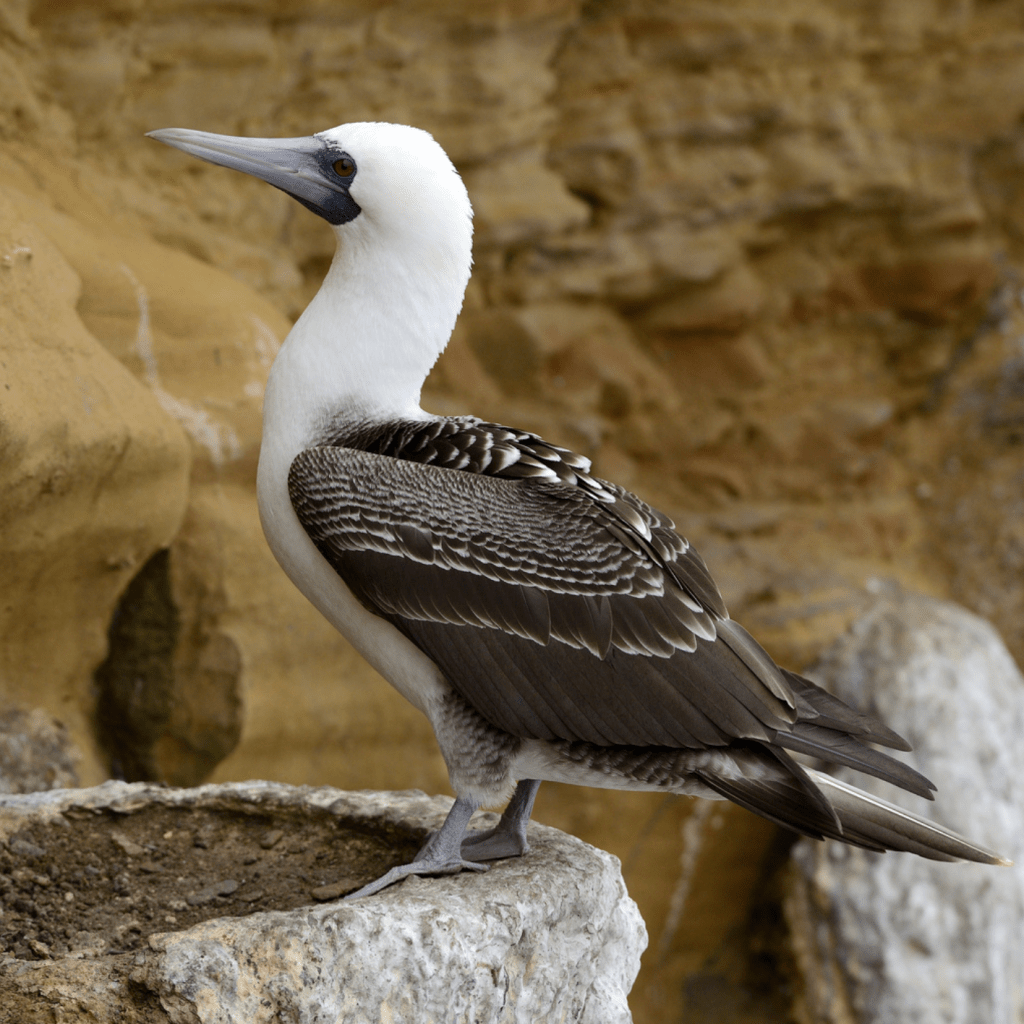
Along the river valleys that cut through the sands, the landscape turns green with carob trees, reeds, and wild canes. In the far north, where the water is warmer, dense mangrove forests provide a unique habitat for coastal life. The region is also a biological powerhouse due to its nutrient-rich waters, which support massive populations of anchovies, sea lions, and guano-producing seabirds like the piquero.
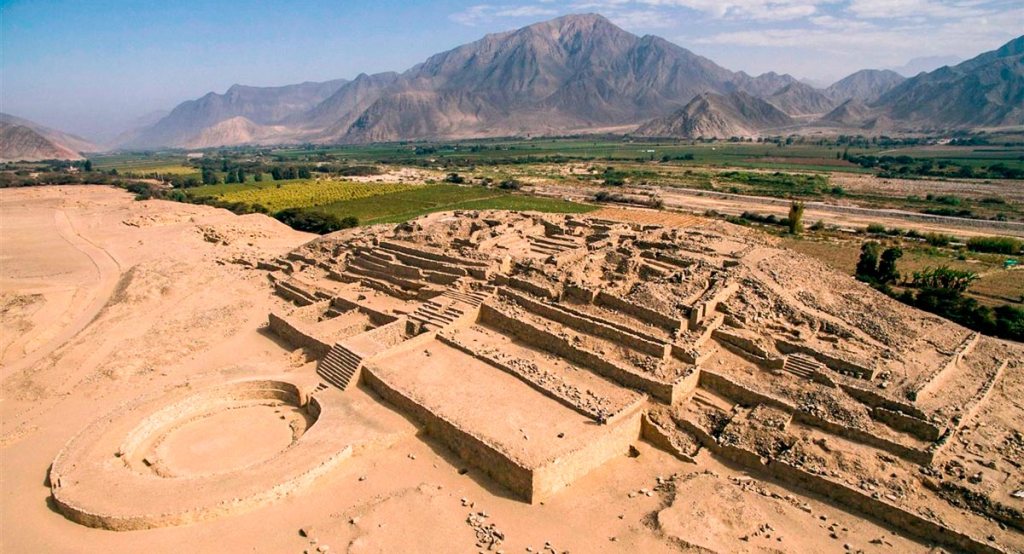
Historically and economically, the Coast is the heart of Peru. It was home to ancient civilizations like Caral and remains the most densely populated region today, hosting major urban centers like Lima. Life here is a constant balance between the barren desert and the incredible wealth of the sea and river oases.
There were many indigenous groups that settled along the coast. But one group stands out for their incredible, out of this world gigantic line drawings in the sand (geoglyphs) The Nazca.
The Nazca (or Nasca) civilization, which flourished along Peru’s arid southern coast between 100 BCE and 800 CE, is most renowned for the enigmatic Nazca Lines—massive geoglyphs etched into the desert floor that depict animals, plants, and geometric shapes best viewed from the air. Beyond these grand displays, the Nazca were masters of desert survival, engineering a sophisticated system of underground aqueducts known as puquios that provided water in one of the driest places on Earth. Their culture was equally rich in artistry, characterized by vibrant, polychrome pottery and intricate textiles that often featured “trophy heads” and supernatural beings, reflecting a complex religious life deeply tied to fertility and the harsh whims of their environment.
The Nazca lines consist of over 800 straight lines, 300 geometric figures, and 70 animal and plant designs, known as biomorphs. What makes the Nazca Lines so impressiveis that they are giant “mystery drawings” in the dirt that have stayed perfect for over 1,500 years! Even though they are just made of shallow trenches, the desert where they sit has almost no wind and almost no rain, so the drawings never blew away or washed away. It’s like a giant chalkboard that nobody ever erased.
Here are some of the most famous ones:
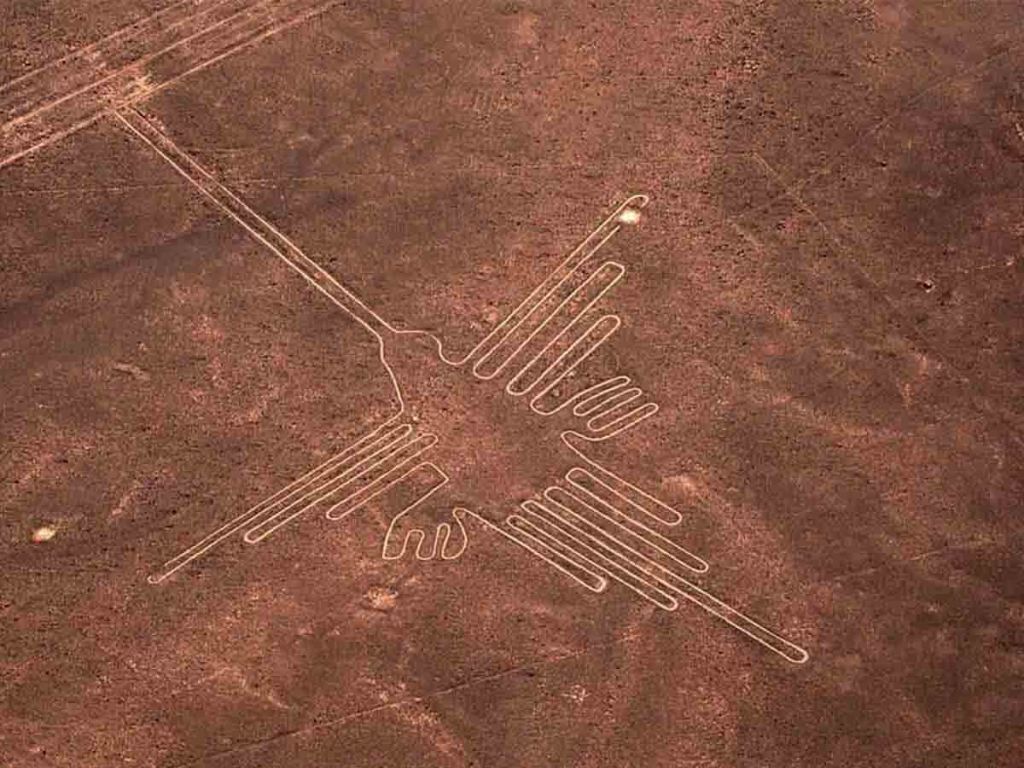
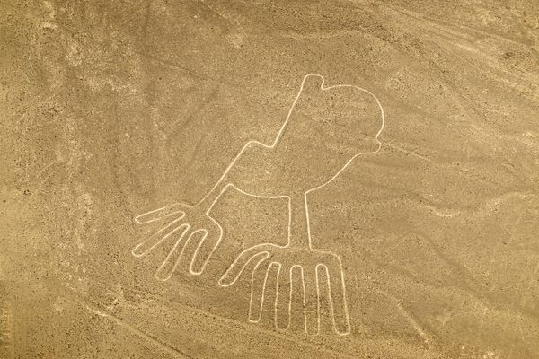
The Nazca Humming Bird measures Approximately 96 meters (315 feet) from the tip of its long, pointed beak to the end of its tail. Its wingspan is roughly 66 meters (216 feet). If you were to stand the Nazca hummingbird up on its beak and lean it against a modern skyscraper, it would reach roughly the 30th or 31st floor!
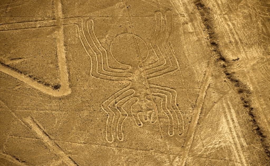
The Nazca Spider is one of the most anatomically fascinating geoglyphs, measuring approximately 46 meters (150 feet) in length. While it is roughly half the size of the Hummingbird, it is still a massive feat of ancient engineering. If you were to stand the spider upright on its front legs against a city building, it would reach approximately the 15th floor. To imagine its width, the span of its eight legs would easily stretch across a wide, four-lane highway. Interestingly, the design is famous for its “extended” leg on the bottom right, which researchers believe may be a representation of the reproductive organ of a Ricinulei, a rare spider found in the Amazon—adding a layer of biological mystery to its impressive scale.
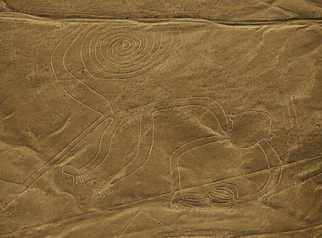
The Nazca Monkey is one of the most playful and recognizable figures in the desert, famous for its large, coiled spiral tail. It measures approximately 110 meters (360 feet) in length, making it significantly larger than both the Spider and the Hummingbird. If you were to stand the monkey upright on its feet and stretch it toward the sky, it would reach roughly the 35th or 36th floor of a modern skyscraper! Its massive hands, which notably feature only four fingers on one and five on the other, are each the size of a large studio apartment.
Though the lines had been there for hundreds of years, the first person to see they were figures was Paul Kosok. Paul Kosok was an American historian who became the first person to realize the Nazca Lines were actually giant, intentional designs while flying over them in 1941. While he was in Peru to study ancient irrigation systems, he looked out his airplane window and noticed that what appeared to be “roads” from the ground actually formed the distinct shape of a bird. By a stroke of incredible timing, he observed the sun setting exactly at the end of one of the lines on the Winter Solstice, leading him to famously describe the desert as “the largest astronomy book in the world.” His discovery transformed the lines from ignored dirt paths into one of the world’s greatest archaeological mysteries, sparking decades of research into how and why they were built.
Fortunately for the world, he had an incredible assistant: Maria Reiche, a German-born mathematician who became known as the “Lady of the Lines.” She devoted over 40 years of her life to protecting and studying the Nazca geoglyphs. After working as an assistant to Paul Kosok, she became so obsessed with the desert’s mysteries that she moved into a small, simple house nearby, often seen sweeping the lines with a household broom to keep the dust from obscuring them. Reiche used her mathematical background to measure the figures with incredible precision, arguing they were a giant astronomical calendar that mapped the stars and seasons. Her fierce dedication is the reason the lines were declared a UNESCO World Heritage site, and she is still a national hero in Peru today for saving the drawings from being destroyed by modern roads and foot traffic.
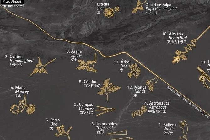
This is a map depicting some of the geoglyphs and their location:
Let’s see them from above!
And this video shows great footages of the coast of Perú:
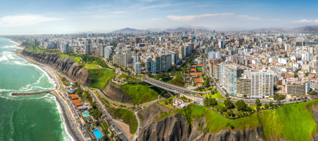
Lima
Lima, the capital of Peru, was founded by the Spanish conquistador Francisco Pizarro on January 18, 1535. Originally named La Ciudad de los Reyes (The City of Kings) to honor the feast of the Epiphany, the city’s official name eventually shifted to Lima, a Spanish variation of the indigenous Quechua word Rímac, which means “talking river.” Established in the Rímac River valley of the Chala region to provide a strategic coastal gateway for trade, this sprawling desert metropolis now serves as Peru’s political and economic heart. Today, it blends a deep colonial history and ancient adobe pyramids with a modern reputation as a global gastronomic capital, housing nearly a third of the country’s population beneath its famous coastal mist.
HERE is a beautiful 360 view as well.
La Sierra
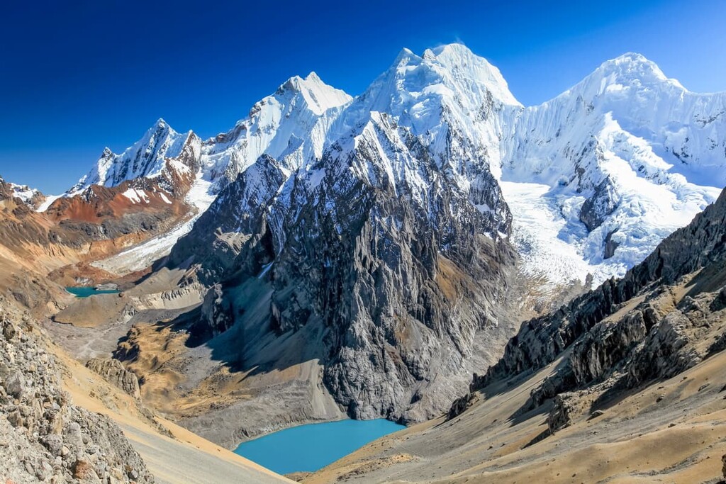
The Sierra (the Peruvian Andes) represents the rugged, vertical backbone of the country, starting at 1,640 feet and defined by an average elevation of approximately 13,000 feet. The region is dominated by the Cordillera Blanca, the highest tropical mountain range in the world, which contains the country’s most iconic natural formation: Nevado Huascarán. Reaching a staggering 22,205 feet, Huascarán is not only the highest point in Peru but the highest peak in the entire Earth’s tropics. This verticality creates a “staircase” of ecosystems, where a single mountain can host a temperate valley at its base and a glaciated tundra at its summit, separated by only a few miles of climbing.
Huascarán National Park
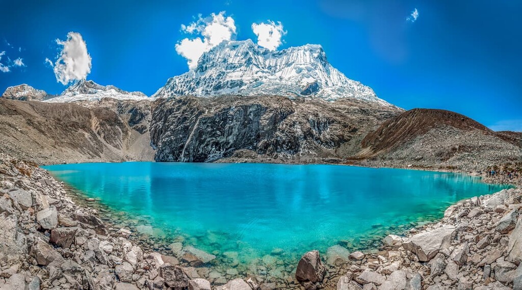
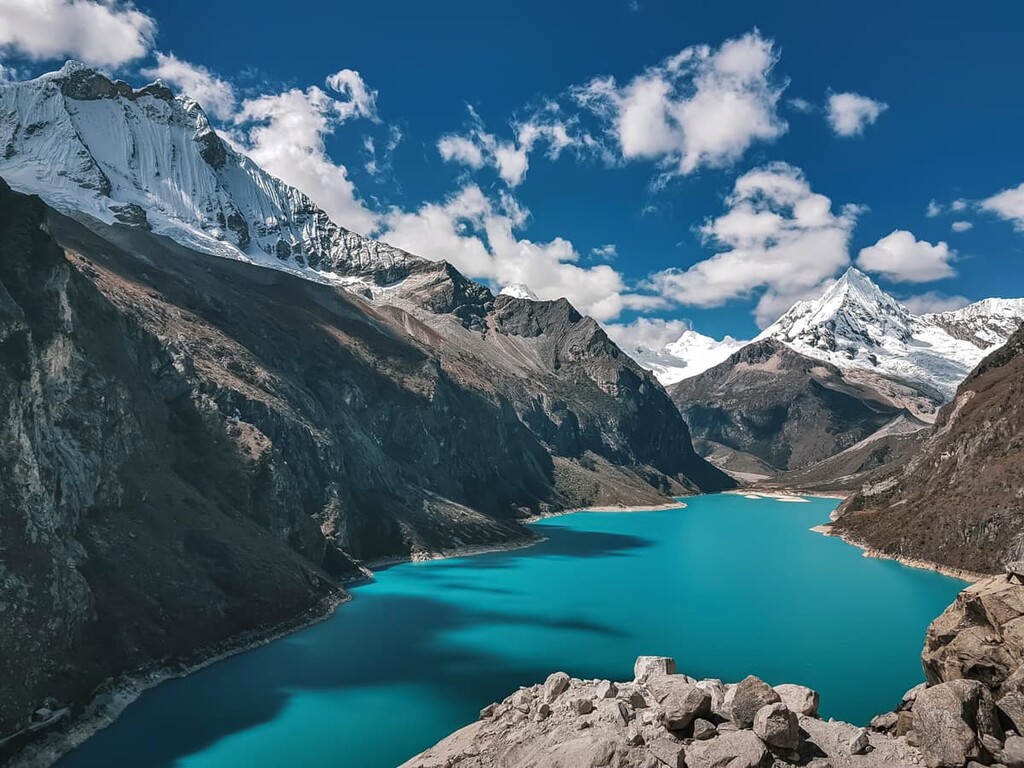
Established in 1975 and currently celebrating its 50th anniversary, Huascarán National Park is a UNESCO World Heritage site that protects the heart of the Cordillera Blanca, the world’s highest tropical mountain range. Spanning approximately 840,000 acres, the park is a dramatic high-altitude sanctuary containing 27 peaks over 20,000 feet, more than 600 glaciers, and nearly 300 stunning turquoise glacial lakes like Laguna 69 and Llanganuco.
While the park is a premier destination for world-class trekking and mountaineering, it currently faces significant challenges from climate change; in fact, as of early 2026, authorities have implemented temporary restrictions on high-altitude climbing above 16,400 feet (5,000 meters) to protect both the receding glaciers and the safety of climbers from increasingly unstable ice conditions.
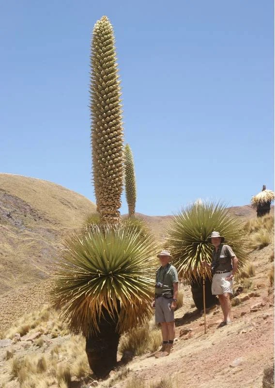
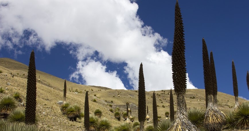
It serves as a vital refuge for rare Andean wildlife, including the spectacled bear, the Andean condor, and the prehistoric-looking Puya raimondii plant, which can grow up to 40 feet tall.
Puya raimondii (Queen of the Andes)
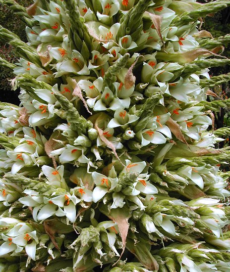
The Puya raimondii, or “Queen of the Andes,” is the world’s largest bromeliad, growing up to 40 feet tall in the high-altitude puna. This “living fossil” lives for nearly 100 years but blooms only once at the end of its life, producing a massive spike with 8,000 to 20,000 flowers and millions of seeds before finally dying.
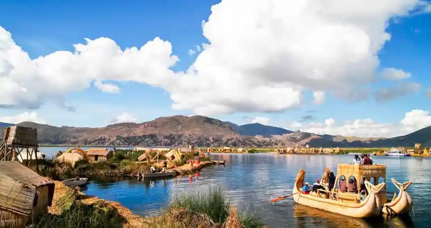
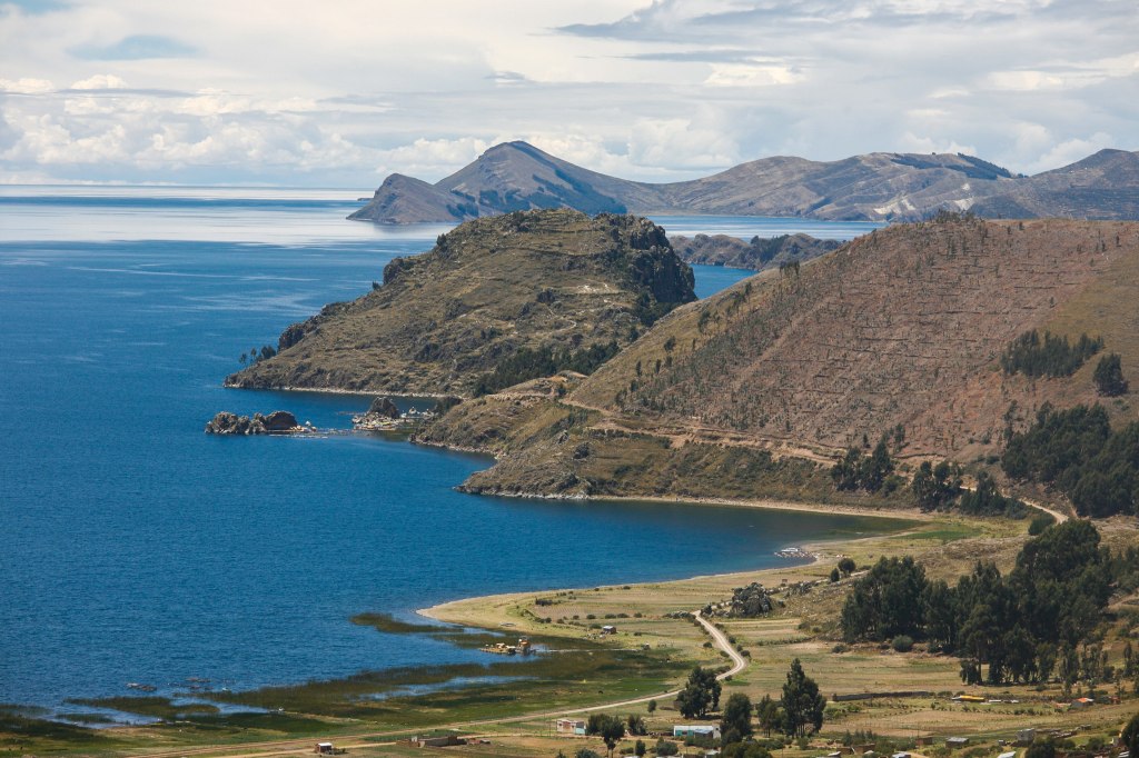
The climate of the modern Sierra is dictated by altitude and a strict seasonal cycle rather than the humidity of the coast. Temperatures fluctuate wildly between day and night; in high-altitude cities like Cusco or Puno, a sunny afternoon might reach 65°F to 70°F, while a clear night can see the mercury plunge to 30°F or lower. Unlike the desert coast, the Sierra experiences a distinct rainy season from November to April, which transforms the brown, high-altitude grasslands—known as the Puna—into vibrant green pastures. This region also holds the Altiplano, a massive high-altitude plateau shared with Bolivia, which sits at an average of 12,500 feet and contains Lake Titicaca, the highest navigable lake in the world.
Lake Titicaca is a place of immense cultural and spiritual importance, according to Incan mythology, the sun and the first Incas emerged from its deep blue waters. Today, it remains famous for its unique “floating islands” made entirely of bundled totora reeds by the Uru people, who have lived on the lake for centuries to remain mobile and independent.
This is a great video to show a bit of what it looks like… because it is long, watch it ahead of time and choose a portion!
La Selva
The Selva is Peru’s largest and most biodiverse region, representing the vast Amazonian rainforest that covers over 60% of the country. Geographically, the region begins on the eastern slopes of the Andes at an elevation of approximately 3,300 feet, where the cool mountain air transitions into the “Ceja de Selva” (Eyebrow of the Jungle), a high-altitude cloud forest characterized by constant mist and moss-covered trees.
As the elevation drops below 1,300 feet, the landscape flattens into the Selva Baja, a massive tropical plain where the climate remains a consistent and steamy 80°F to 95°F year-round. This lower basin is defined by its massive, winding river systems—including the mighty Amazon—and a dense canopy that creates distinct layers of life, from the dark forest floor to the “emergent” giant trees that tower above the rest.
There is an incredible river called the Shanay-Timpishka. This four-mile-long river features water that reaches temperatures of nearly 200°F—hot enough to brew tea or cook an egg instantly! Unlike most hot springs that are powered by nearby volcanoes, this river is a rare scientific marvel because there are no volcanoes in the area. Instead, as a Peruvian geoscientist named Andrés Ruzo in 2011 realized, the water is heated deep inside the Earth’s crust and forced back up through a fault line (or crack coming from deep the Earth’s core, creating a steaming, bubbling “enchanted” river that flows right through the middle of the rainforest.
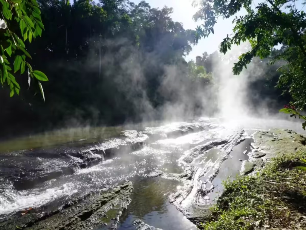
According to local tradition, the river’s heat comes from Yacumama (Mother of the Waters). She is depicted as a colossal serpent spirit that lives in the depths of the Earth. The legend says that Yacumama is so powerful that she “cooks” the water as it passes through her body. At the headwaters of the river, there is a large rock formation that looks like a snake’s head, which locals believe is the spot where the serpent spirit births the boiling water into our world.
The name Shanay-timpishka is fascinating because of that translation: “boiled with the heat of the sun.” While the sun doesn’t literally heat the water, the name reflects the ancient belief that the river’s energy is connected to the celestial power of the sun. Local shamans often visit the river to communicate with spirits and use the water for healing rituals, believing that the steam carries prayers to the spirit world.
There are so many incredible animals in the rainforest. It is so hard to choose one… but I found that maybe you’ve never heard of.
The Hoatzin
Also known as the dinasour bird, and the stinkbird, the Hoatzin (Opisthocomus hoazin) is a very strange bird that is native to the Amazon Rainforest. It lives and nests in branches usually over rivers. It looks like this as an adult bird:
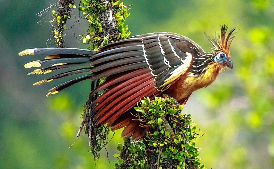
Beautiful huh? Now there are two facts that make this bird unique. One is that as a young bird, it can swim and then climb trunks with… claws it has in its wings! The second and truly unique fact is that like a cow, it has a fermenting stomach! So because it only eats leaves, and it ferments the leaves, it stinks like manure! (Yes cow’s poop!). See if you can see the claws on the baby bird’s wings in the following photo:
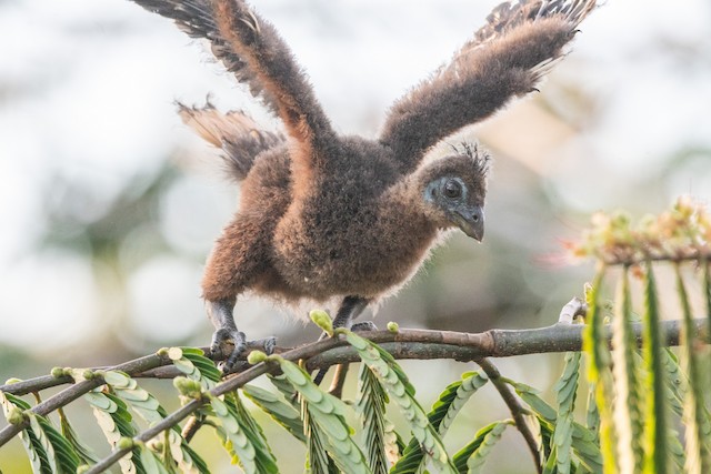
Watch this video to see a Hoazin chick climb! It is incredible!
Ready to learn about an incredible plant now?
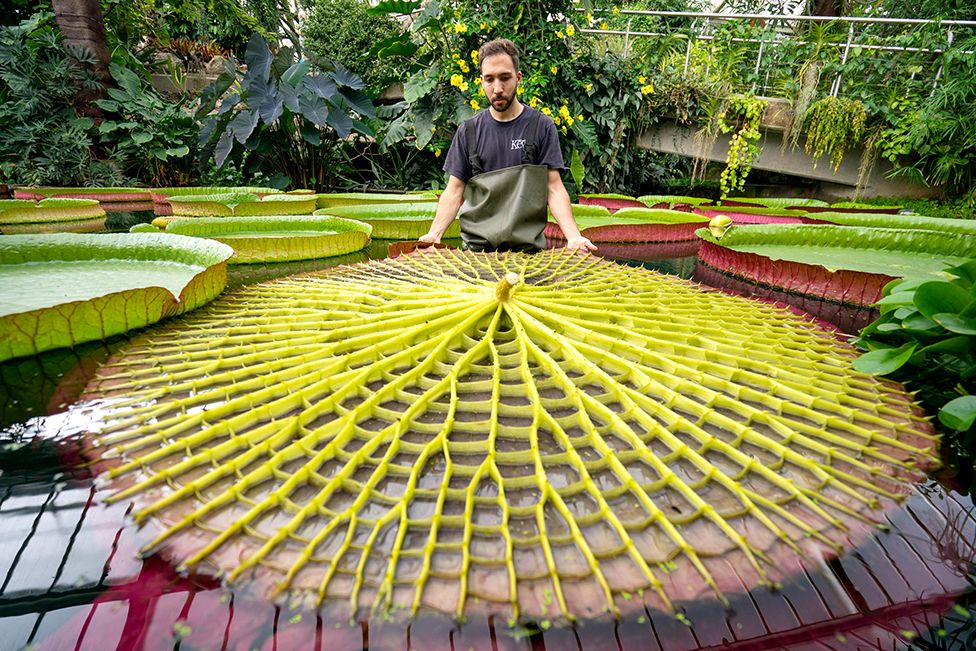
Well I will tell you that the leaf of this plant can grow to be up 10 feet in diameter! It is so strong it can hold a small child up to 100 pounds! Can you guess what plant it is?
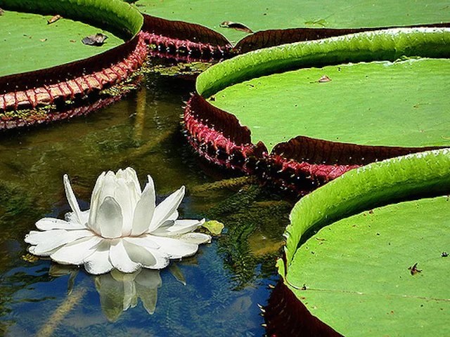
Victoria Amazónica
This plant is a giant water lily! that thrives in the “oxbow lakes” (cochas) and slow-moving backwaters of the Ucayali and Marañón rivers, which eventually join to form the Amazon River. An oxbow lake is a U-shaped body of water that forms when a wide meander (a big curve) from a river is cut off. It has calm waters too.
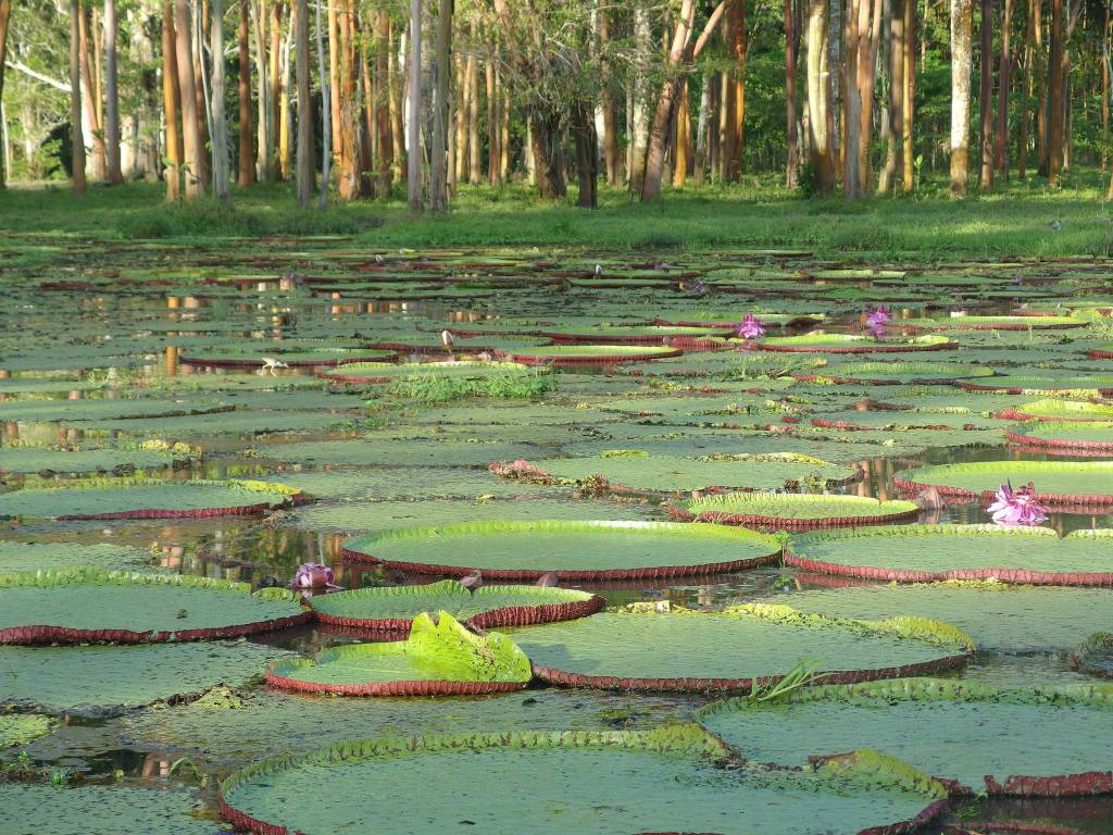
How would you like to sit on one?
Well this concludes our travels through the three geographical regions of Peru.
