About Spain’s Location
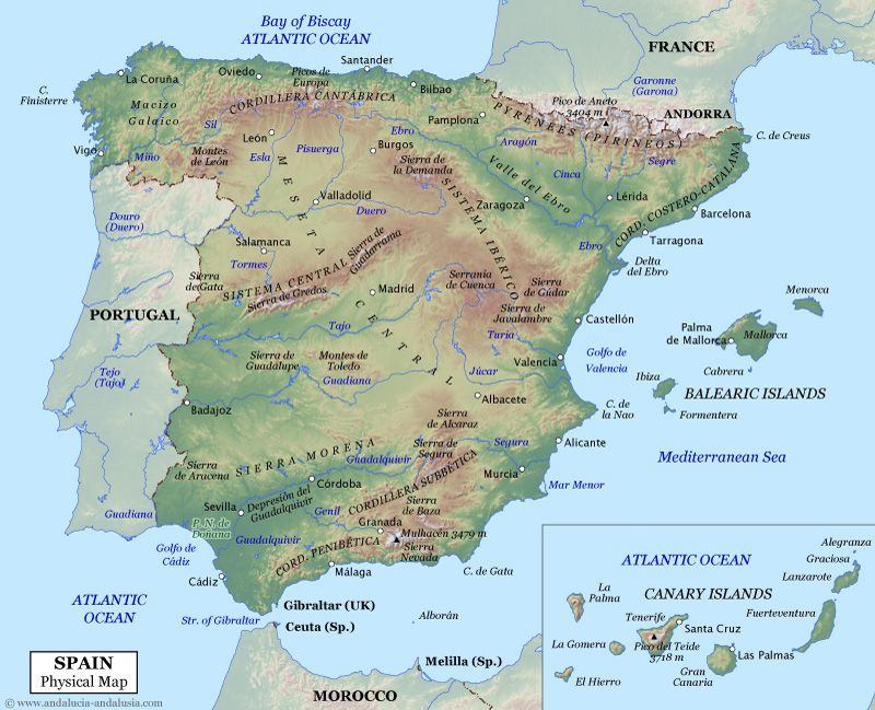
Spain is a country located in the south in Western Europe. The main land is located in a peninsula called the Iberian Peninsula (Peninsula Ibérica). A peninsula is a piece of land that is surrounded by water except for one part called the isthmus that connects it to a bigger piece of land.
Spain shares the peninsula also called the Iberian Peninsula with Portugal, a country in the west. It also shares land boundaries with France and Andorra along the Pyrenees mountains (Los Pirineos) and with the small British territory of Gibraltar near the southernmost tip. On most of the south and west it borders with the Mediterranean Sea. On the north and part of the southwest it borders with the Atlantic ocean.
Off the peninsula Spain has other areas: The Balearic Islands in the Mediterranean and The Canary Islands to the west of Africa. It also has an exclave, a city in France called Llívia and five places of sovereignty (Plazas de Soberania) in Morocco: Ceuta, Islas Chafarinas, Peñon de Alhucemas and Peñon de Velez de la Gomera.
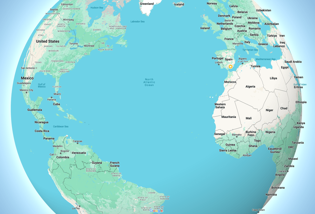
Spain in Google Maps
A little commercial… this is a new book I created to learn about Spain! It is especially for children K-3rd grade and covers location, geography, history in 3 parts, political division into communities, culture including festivals, visual arts and cuisine. It comes in two formats and with lesson plans. It also has Slides presentations links full of photos and videos to show your student/students. Here is a preview in PDF:


FIND THE BOOK HERE!
And now here are the…
Geographical Regions of Spain
1. The Peninsula
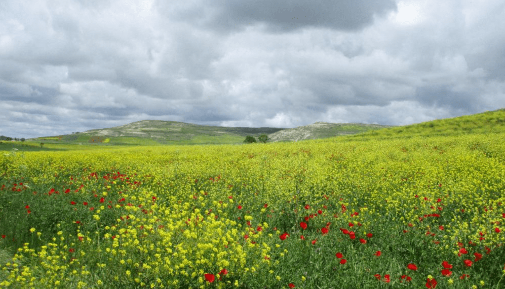
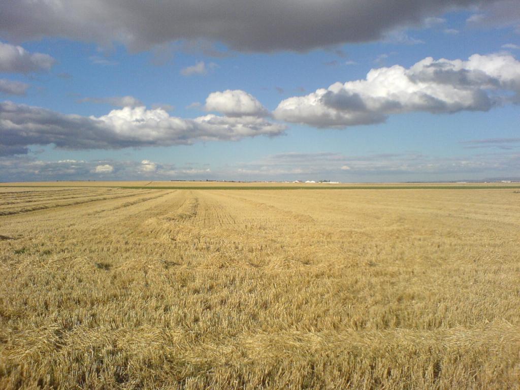
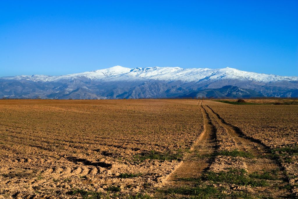
Spain’s peninsula area has a table like structure in the middle! Meaning that a piece of land rises high but it’s flat on the top (like a table). The word mesa means table in Spanish! This part of Spain changes through the seasons becoming very dry in the summer as it receives very little rain.
The Meseta in the Spring:
The Meseta in the summer:
There are a couple of mountain ranges within the peninsula: the central system and the Toledo mountains. In this last one you can see windmills! Take a look. It is fun to count how many windmills there are in Spanish to the beat of the music.
Northern Spain
This area is also referred as the green area of Spain as it is covered with green lush pastures and hills that get the most rain in the country. The mountains in the north of Spain encompass the Galician Mountains (Montañas Galicias) on the northwest, the Mountains of Leon (Los Montes de León), the Cantabrian Range (La Coordillera Cantábrica) in the north which reach heights of 8,500 ft (2,591 m), the Basque Mountains (Los Montes Vascos) and the Pyrenees Mountains (Los Pirineos) that Spain shares with France stretching for 260 miles (418 km) and reach at its highest point 11,168 feet (3,404 m) at the Pico de Aneto.
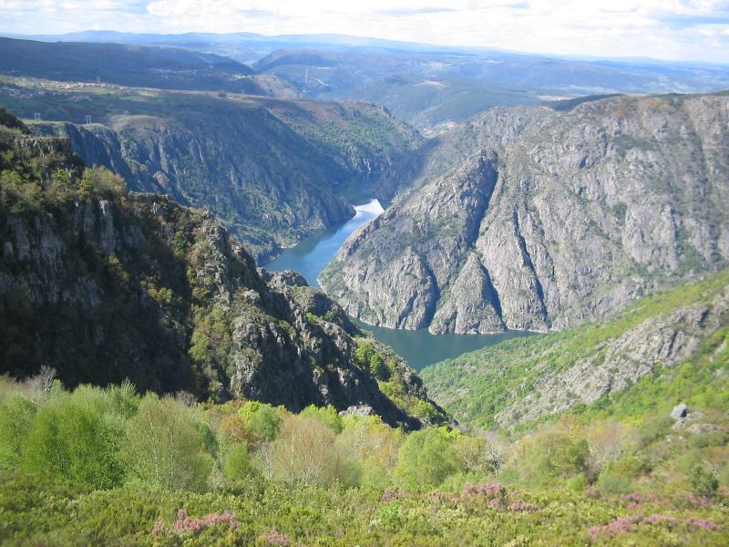
The River Sil passing through Lugo province in the Galician mountains. Cr.en-academic. com
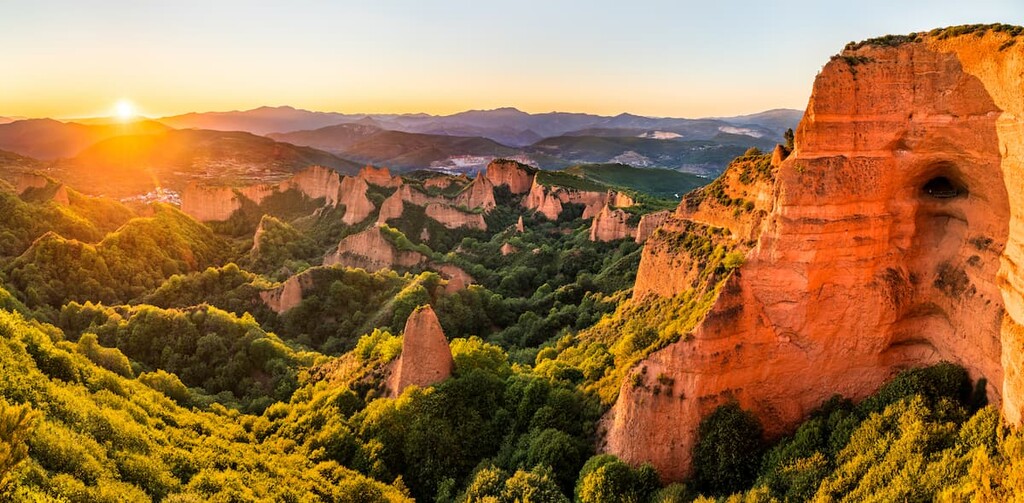
“Las Medulas” in the Mountains of Leon. These mountains were once where the biggest gold mine in whole of the Roman Empire was located! While the Romans were extracting gold, through excavations and a novel system of aqueducts, they also modified and eroded the contours of the land. The passage of time has taken care of the rest. The result is an incredible landscape where the russet tones of the rock contrast with the green of the vegetation. It is listed as UNESCO World Hetitage Site.

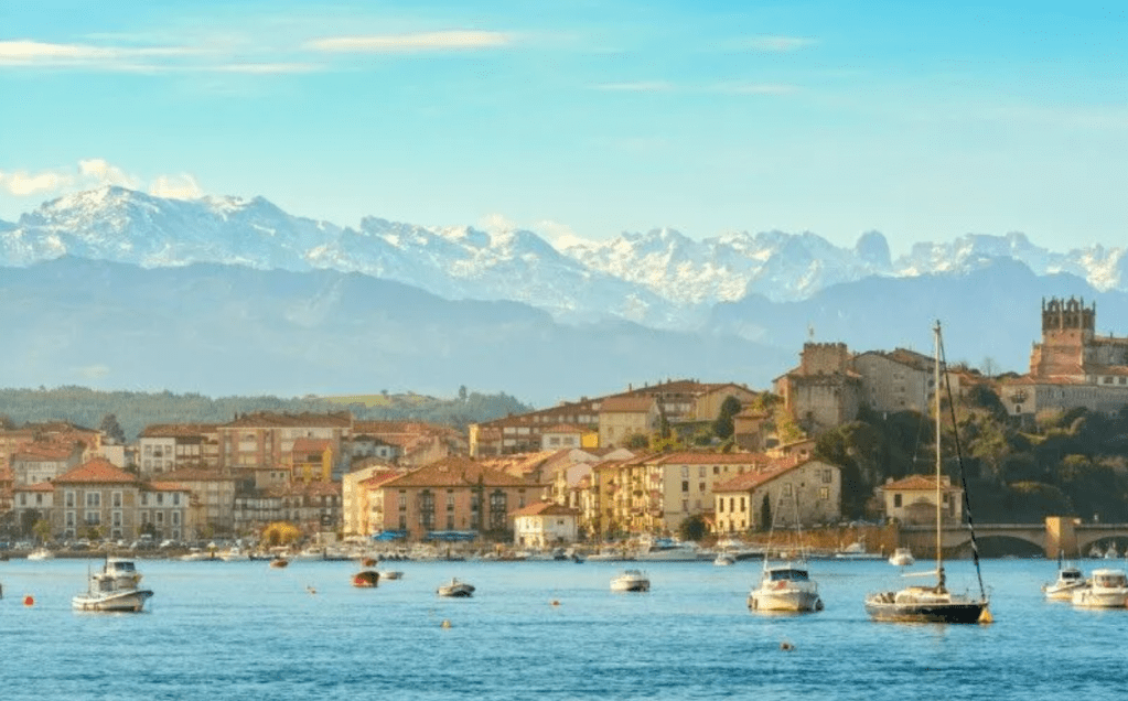
The Cantabrian mountains and the town San Vicente de la Barquera. Cr. Fascinating Spain. com
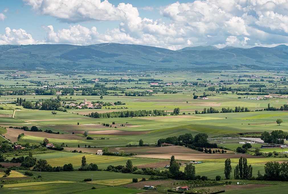
General view of the Alava Plains in the Basque Mountains. Cr. Hotel País Vasco

The beauty of the Pyrenees Mountains.
There are over 19,000 mountains in the Pyrenees and they extend along 7335 mi2 (19,000 km2). The highest mountain is Peak Aneto (Pic Aneto) at 11,168ft (3404 m). This is the third tallest mountain in the territory of Spain.
Pico Aneto. Cr. Grome CC.
This is a drone video of the Pyrenees, Aneto Peak is included…
Eastern Spain
In the East, Spain has three mountain ranges: The Iberian System (El Sistema Ibérico) , The Catalan Coastal Range (La Cordillera Costera Catalana) and the Baetic System (EL Sistema Baetico).
The Iberian System (El Sistema Ibérico), mountain range borders the Meseta Central on its eastern end and separates the Meseta Central from the Ebro valley and from the Mediterranean coast.

Parque Natural de las Bardenas Reales, one of the biggest desert like areas in Spain. Cr. peakvisor. com
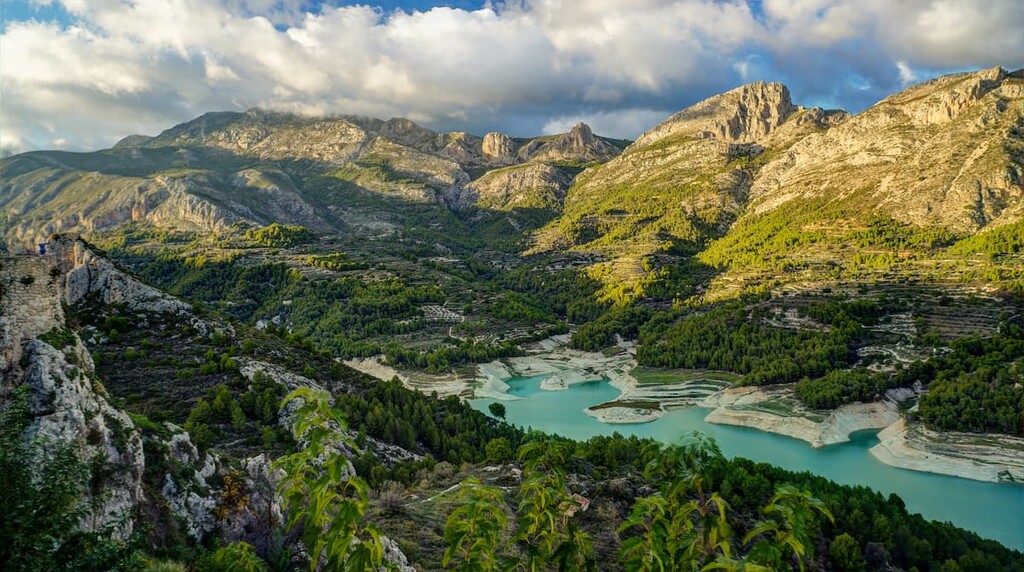
Village Guadalest, Alicante. Cr. peakvisor. com
The Catalan Coastal Range, runs parallel to the Mediterranean coast. It is between the Pyrenees and the mouth of the Ebro River in Catalonia. There is also a Catalan Pre-Coastal Range that has higher mountain massifs including the beautiful Montserrat Mountain (4,052 ft (1,236 m) at its highest point.)

View of the Monastery of Monserrat at the Monserrat Mountain. Cr. Peakvisor
Shall we go explore there? GO HERE. It is so beautiful!!!
Located in the Baetic System, the highest peak in the Peninsular Region of Spain is Mulhacén at 11,421 feet (3478 metres), in the Sierra Nevada mountain range.
The beautiful Sierra Nevada. Cr. Wikimedia Commons: Antonio Morales García

Mulhacén Peak. Cr. Explore-share. com
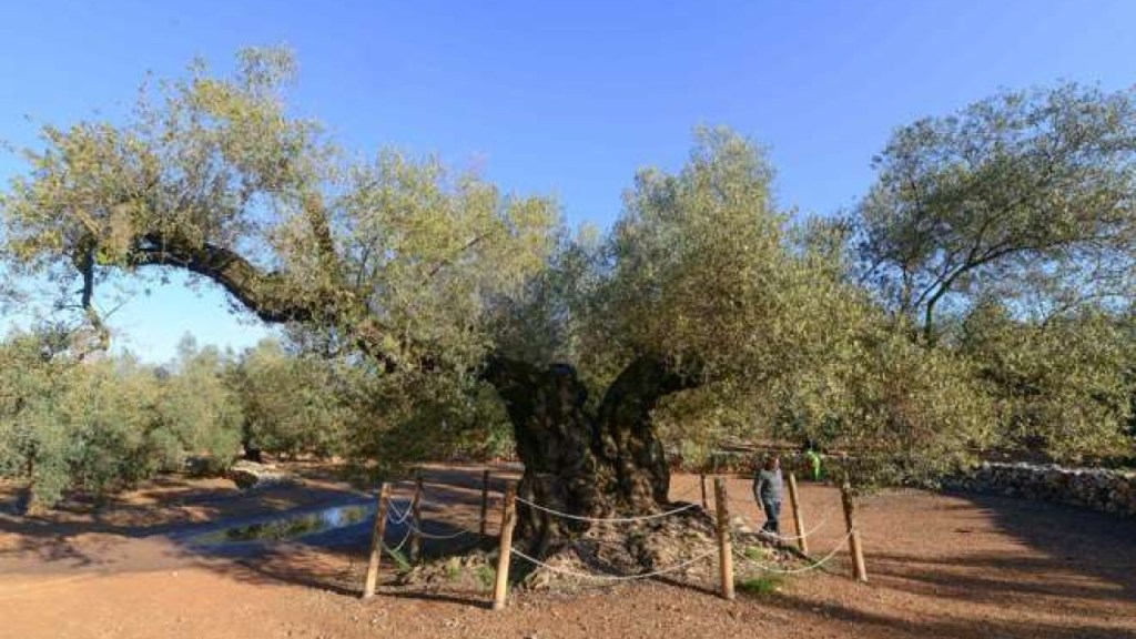
All over Spain there are olive trees, but in a special area in southern Catalonia there are many trees that are olive groves (groups of olive trees) that are over 1700 years old… from Roman times! La Senia and Ulldecona, are credited with the highest concentration of thousand+ year old olive trees in the world. There are over 400 trees that have been catalogued, and two of them have received “heritage tree” status by the Catalan government. To qualify as one of these ancient olive trees, the diameter of the trunk has to be more than 3.5 meters, measured at a height of 1.3 meters from the ground.
This 1,700-year-old tree called: Farga de l’Arión is the oldest olive tree in Spain that has been scientifically catalogued:

Southern Spain
The Sierra Morena (La Sierra Morena), stretches for 1476ft (450km) from east to west across the south of the Iberian Peninsula. The Sierra Morena has a diverse landscape of rugged peaks to gentle slopes, cascading waterfalls to ancient olive groves. Beneath the lush vegetation lies a fascinating geological history. Ancient rocks such as granite, quartzite, and slate dominate, weathering into distinctive formations. Mineral deposits have long attracted humans, with mining for silver, lead, copper, and mercury leaving a historical imprint on the region like in the UNESCO Global Geopark: Sierra Norte National Park.

The Iron Mountains in the Sierra Norte National Park.
Spain is blessed with a lot of access to water and much sunshine year round . Here you can see some of its beautiful beaches:

Playa de Albir, Alicante

EL Playazo, Cabo de Gata Nature Reserve, Costa de Almeria
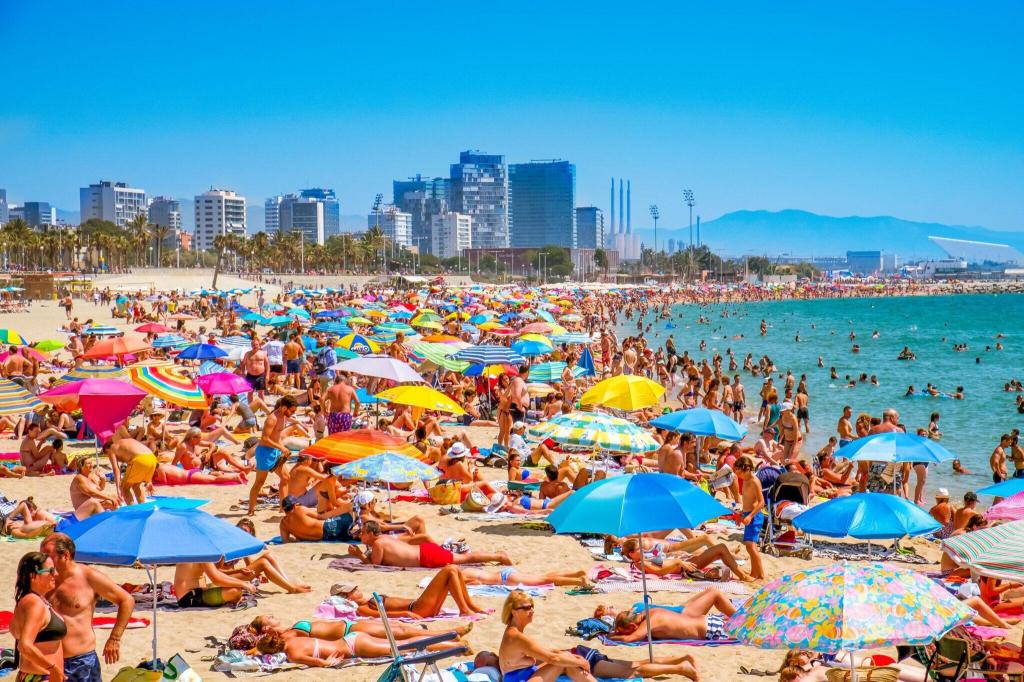
Bogatell, Barcelona
And talking about beaches, let’s take a quick looka at Spain’s main islands:
Spain’s Main Islands
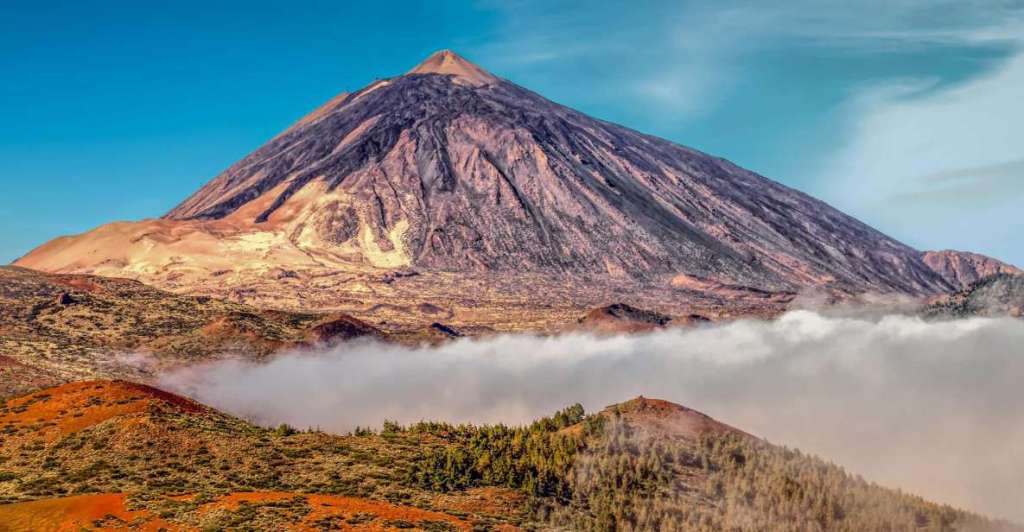
Spain has two sets of bigger islands: Las Islas Baleares (The Baelaric Islands) that include Mallorca, Menorca and Ibiza and Las Islas Canarias (The Canary Islands) that include among many Tenerife, La Palma and Gran Canaria.
The Canary Islands, are known to have great weather as it is deliciously sunny 360 of the 365 days of the year! In the island of Tenerife is where the highest mountain is located… and it is actually a volcano called Monte Teide. Monte Teide’s summit (highest point) is 12,188 ft (3,715 m). If measured from the ocean floor, its height of 24,600 ft!! (7,500 m) makes Teide the third-highest volcano in the world.
Wondering when was its last biggest eruption? 193,501 years ago… fortunately!
If you wish to teach younger children more in depth about the islands or other Spanish places of sovereignty go HERE and scroll way down!
