
For a great activity 3rd-12th grade to complement this page with information about Spain’s Geography go HERE. Students will create something like this:

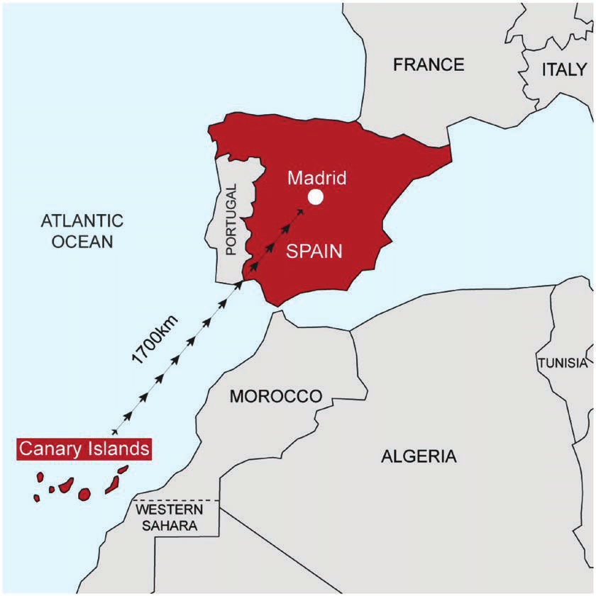
Spain is a country located in most of the Iberian Peninsula (about 82%) in South Western Europe. Spain is bordered to the west by Portugal (also on the Iberian Peninsula) and the Atlantic Ocean, to the north by France, Andorra, and the Bay of Biscay and to the south and east almost entirely by the Mediterranean Sea (except for the small British territory of Gibraltar).
Spain also includes a small exclave inside France called Llívia, as well as the Balearic Islands in the Mediterranean, the Canary Islands in the Atlantic Ocean 108 km (67 mi) off northwest Africa, and five places of sovereignty (plazas de soberanía) on and off the coast of North Africa: Ceuta, Melilla, Islas Chafarinas, Peñón de Alhucemas, and Peñón de Vélez de la Gomera.
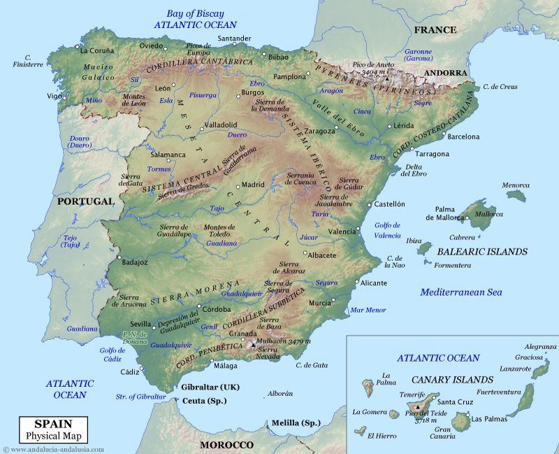
With a land area of 194,897 sq mi (504,782 square kilometres) in the Iberian peninsula, Spain is the largest country in Southern Europe, the second largest country in Western Europe (behind France), and the fourth largest country in the European continent (behind Russia, Ukraine, and France). It has an average altitude of 650 m. (1). It is the second country with the most altitude after Switzerland, averaging all its mountain ranges heights and its high inland plateau at over 600 meters. (Switzerland is about 1300 meters).
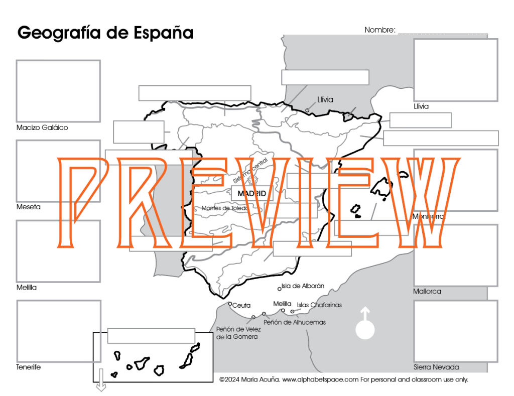
Geographical Regions of Spain
Because Spain has not only the Peninsula but islands, cities in Africa and an exclave in France, this is the way I found to make its geographical studies easier. I will divide it by areas and then each areas by regions within them (if they have them).
Area 1: The Peninsula / La Peninsula
Including: The Meseta (Inner Plateau) with its Central System and The Toledo mountains, and surrounding it clockwise: The Galician Massif, The Mountains of Leon, The Cantabrian Range, The Basque Mountains, The Pyrenees, The Catalan Coastal Range, The Iberian System, The Beatic System and the Sierra Morena.
Area 2: The Balearic Islands / Las Islas Baleares
Area 3: The Canary Islands / Las Islas Canarias
Area 4: Ceuta, Melilla, Islas Cháfarinas, Peñón de Alhucemas, and Peñón de Vélez de la Gomera
Area 5: Llívia (Exclave in France)
Area 1: The Peninsula / La Peninsula
A peninsula is a piece of land that is surrounded by water except one part called the isthmus that connects it to a bigger piece of land. Most of Spain is located on a peninsula called The Iberian Peninsula (La Peninsula Ibérica). Spain has about 82% of this peninsula, most of the west side belongs to Portugal and a small section to the north to Andorra.
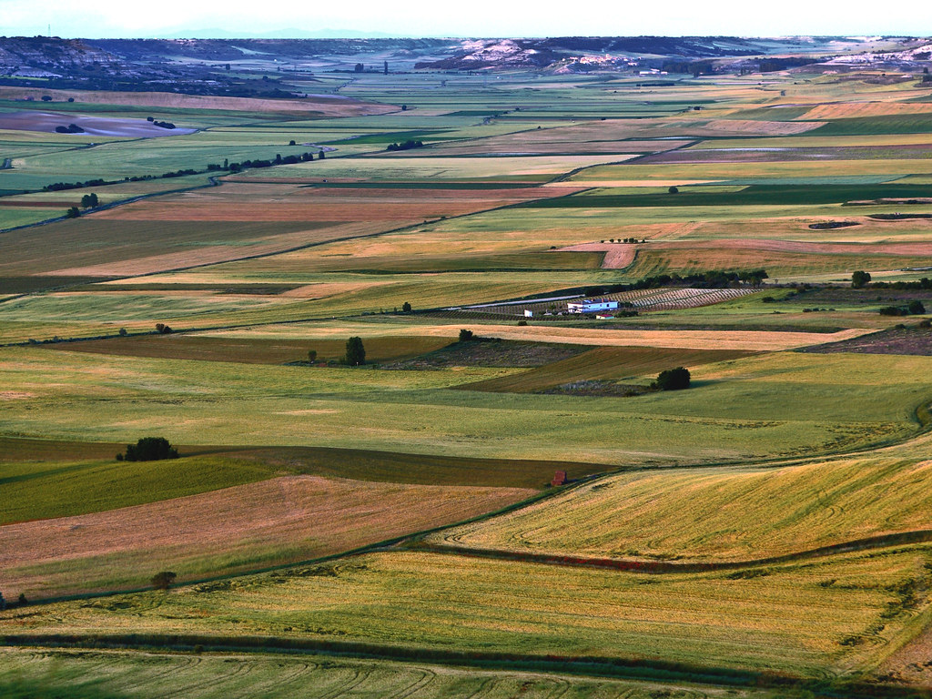
The Inner Plateau / La Meseta Central
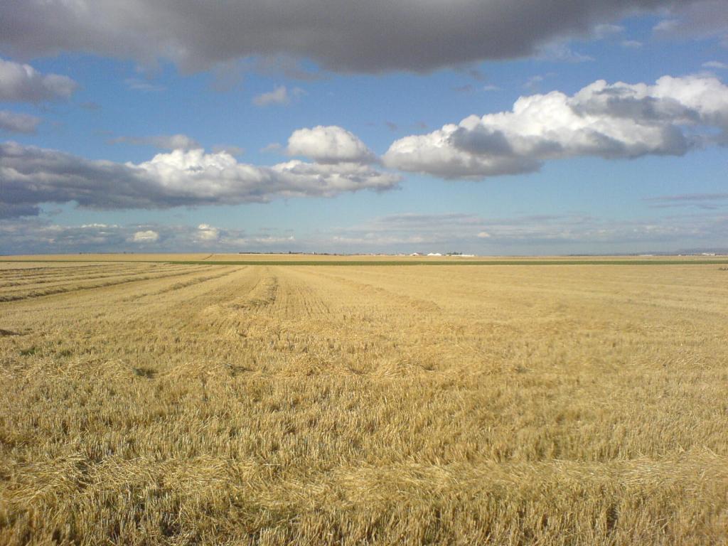
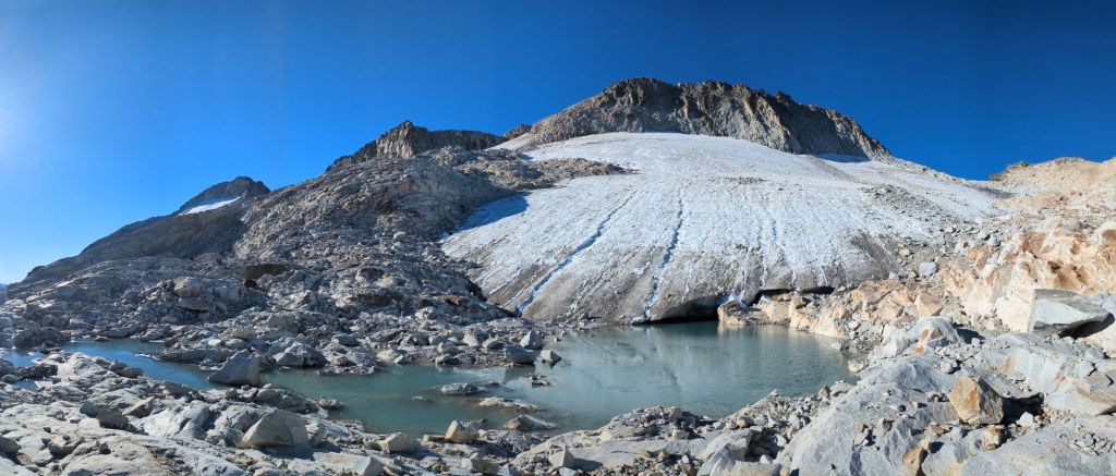
Spain’s land in this peninsula has a huge Meseta Central. Meseta comes from the word mesa meaning table, so it’s basically an inner plateau or land that rises like table and is flat on the top. It is huge, extending over 154,000 square miles and rising about 2200 feet. It is the most ancient land in Spain known as Hercynian, or Variscan formed about 300 million years ago. The Meseta’s diverse terrain includes two major mountain systems: The Central System / El Sistema Central and the Toledo Mountains / Los Montes de Toledo.
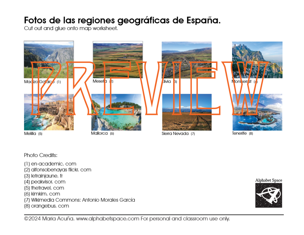
La Meseta Central. Cr. Wikimedia Commons: Rastrojo
Cr. Alfonso Benayas flickr.com
The Central System, stretches from the Iberian System to central Portugal. It divides the Meseta in two: the northern sub-plateau, home to the Duero Valley, and the southern sub-plateau, home to the Tajo and Guadiana valleys. It is divided into the mountains of Somosierra, Sierra de Guadarrama which runs approximately along the border of Madrid and Castile and León autonomous communities, Sierra de Gredos north of the border between Castile and León (which includes Almanzor, the highest peak that rises to 27,900 ft (2592 m) and Sierra de Gata.

The Central System. Cr. peakvisor. com

Pico Almanzor. Cr. Wiki Commons: Hectortrial
The Toledo Mountains (Los Montes de Toledo) separate the Tajo Valley from the Guadiana Valley in the southern sub-plateau.
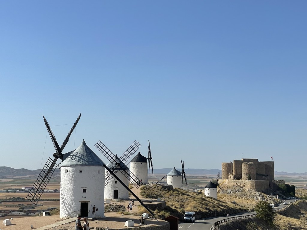
Molinos de Consuegra at the Toledo mountains. There are 12 of the original 13 dating from the 19th century. Cr. Maria G. Acuna 2021
Check out this fun video of the mills:
Surrounding this Meseta there are various mountain ranges.
North of the Meseta
The Galician Massif (El Macizo Galáico), is located in the northwest corner of the country. The notable Cabeza de Manzaneda peak, in the middle of the Massif, rises to (5807ft )1770 metres. The rains are abundant and regular, creating a thick vegetation cover: deciduous forests with heath undergrowth and extensive areas of natural meadows that favor the existence of soft soil.
The River Sil passing through Lugo province in the Galician mountains. Cr.en-academic. com
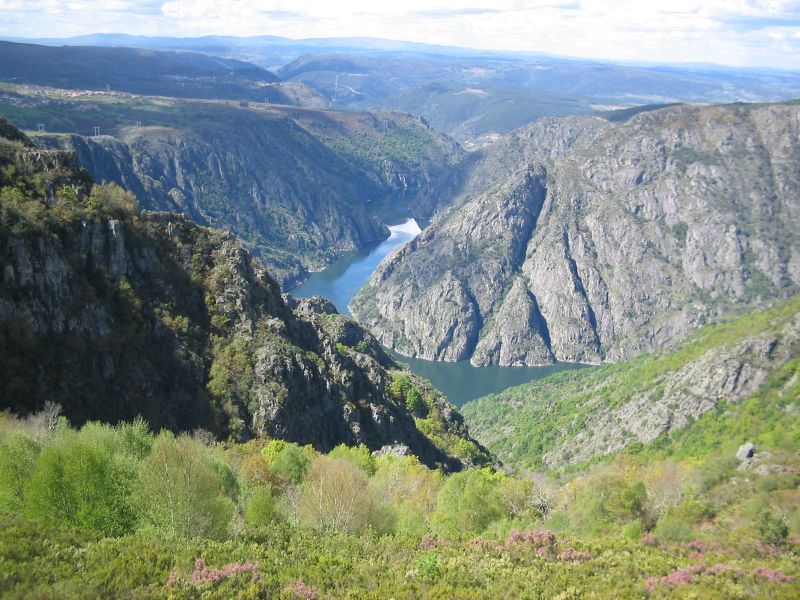
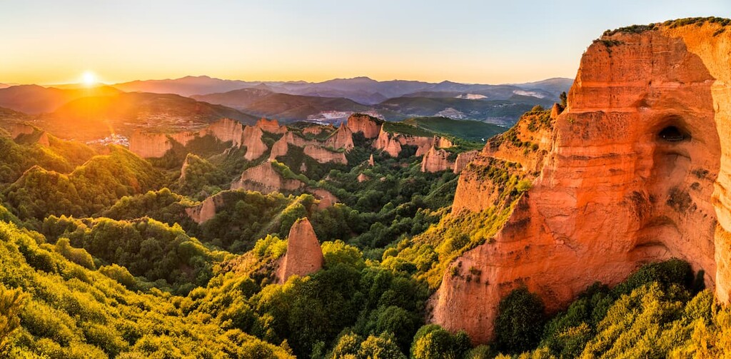
The Mountains of Leon (Los Montes de León), form the northwestern edge of the Meseta. The Mountains of León include the Teleno Mountains and the Segundera Mountains, where elevation rises to around 2000 metres. One of the most beautiful places is “Las Médulas.” Las medulas is where the biggest gold mine in whole of the Roman Empire was located! While the Romans were extracting gold, through excavations and a novel system of aqueducts, they also modified and eroded the contours of the land. The passage of time has taken care of the rest. The result is an incredible landscape where the russet tones of the rock contrast with the green of the vegetation. After advanced aerial surveys conducted in 2014 using LIDAR confirmed the wide extent of the Roman-era works, Las Médulas Cultural Landscape was listed by UNESCO as a World Heritage Site.
Cr. peakvisor. com

Cr. Spain.info
Ths video shows how the Romans mined the mountain:
The Cantabrian Range (La Coordillera Cantábrica), is a limestone formation, runs parallel to, and close to, the northern coast near the Bay of Biscay. Its highest points are the Picos de Europa, surpassing 2,500 m. The Cordillera Cantábrica extends 182 km and abruptly drops 1,500 m some 30 km from the coast.
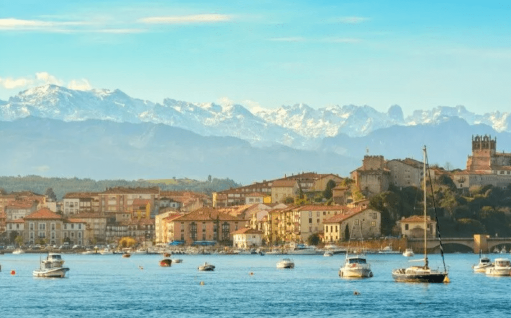
The Cantabrian mountains and the town San Vicente de la Barquera. Cr. Fascinating Spain. com
The Basque Mountains (Los Montes Vascos), are a transitional range between two major ones, the Cantabrian range to the west and the Pyrenees to the east. Geologists call the area “The Basque threshold” and some consider that the Cantabrian Mountains and the Pyrenees are a single greater range and the Basque Mountains are just part of both. There are two parallel sub-ranges running from west to east, the inner one and the coastal one. In between them there is a 500 m high plateau called “Llanada Alavesa” (Alava Plains).
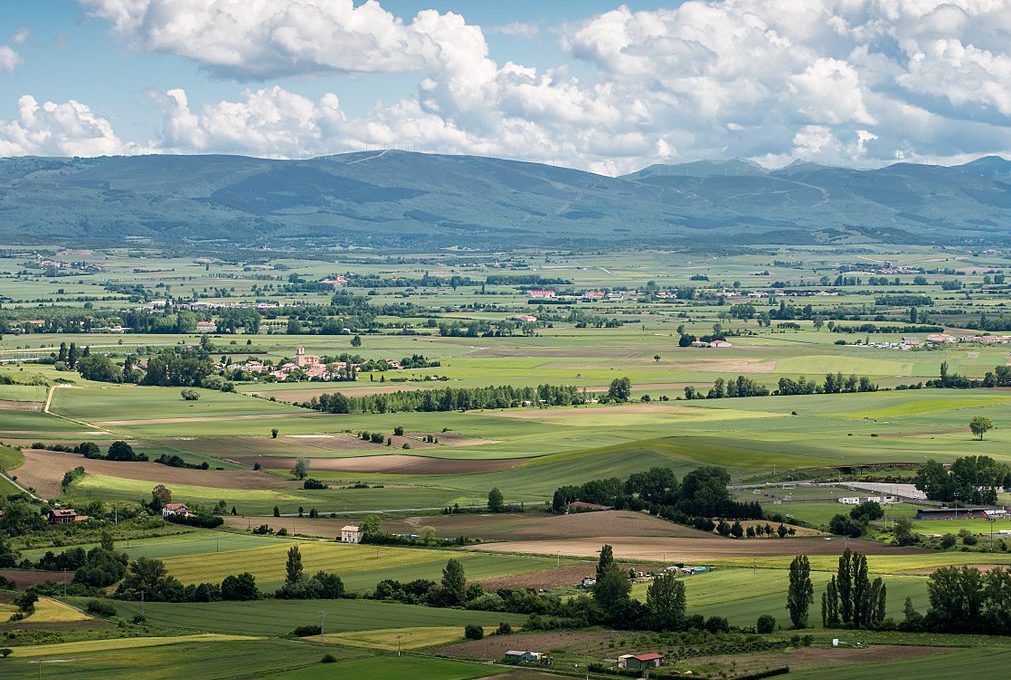
General view of the Alava Plains. Cr. Hotel País Vasco
The Iberian System (El Sistema Ibérico), mountain range borders the Meseta Central on its eastern end and separates the Meseta Central from the Ebro valley and from the Mediterranean coast. It consists of a vast and complex area of mostly relatively high and rugged mountain chains and massifs. It is one of the chief mining regions in Spain since ancient times and sometimes referred as “Cuencas Mineras” (Mining Basins).
Within the region, the range separates many of the watersheds that create many major rivers throughout Spain, including the Ebro, Douro, Tagus, and Guadiana rivers.
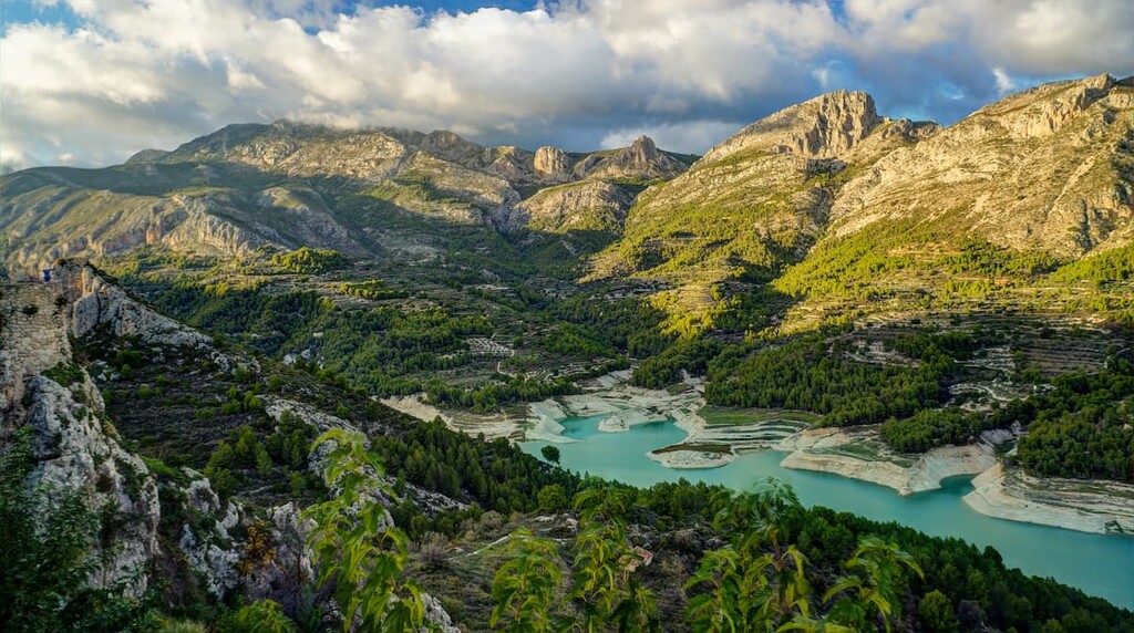
Village Guadalest, Alicante. Cr. peakvisor. com

Parque Natural de las Bardenas Reales, one of the biggest desert like areas in Spain. Cr. peakvisor. com
The Pyrenees Mountains (Los Pirineos), is one of the largest mountain ranges towering across Europe and forms a natural border between Spain and France. Nestled within it lies the tiny country of Andorra. One of the Pyrenees’ most captivating features is its abundance of cascading waterfalls, born from the numerous mountain torrents. In Spain, the Cascada del Cinca flowing at the Ordesa y Perdido National Park is the highest at aproximatelly 1969 ft (600 m).

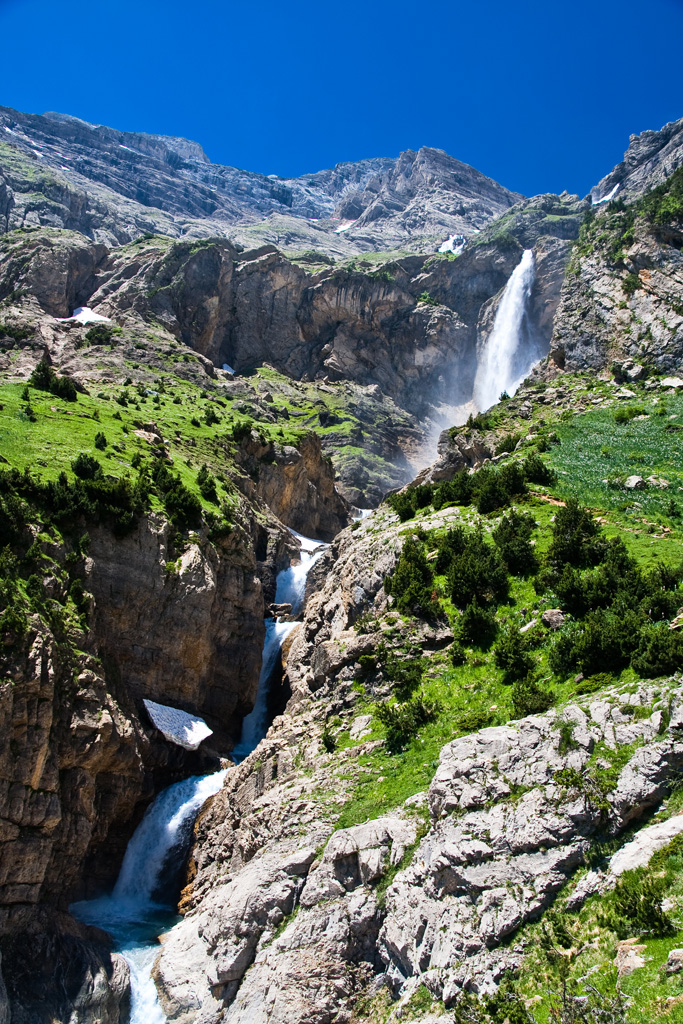
Cascada del Cinca. Cr. excursionesporhuesca. es
There are over 19,000 mountains in the Pyrenees and they extend along 7335 mi2 (19,000 km2). The highest mountain is Peak Aneto (Pic Aneto) at 11,168ft (3404 m). This is the third tallest mountain in the territory of Spain.
Pico Aneto. Cr. Grome CC.
This is a drone video of the Pyrenees, Aneto Peak is included…
Northeast of the Meseta
The Catalan Coastal Range (La Coordillera Costera Catalana), runs parallel to the Mediterranean coast. It is between the Pyrenees and the mouth of the Ebro River in Catalonia. The range does not exceed 2,624 ft (800 m) in elevation. The Catalan Coastal Range consists of ten main massifs, including Montgrí, Massís de l’Ardenya, and Sierra de Collserola. The famous Tibidabo 1,680 ft (512 m), just outside Barcelona, is the highest mountain in the Sierra de Collserola.

View of Barceleona and the Sierra de Collserola National Park. Cr. totcerdanyola. cat
There is also a Catalan Pre-Coastal Range that has higher mountain massifs including the beautiful Montserrat Mountain (4,052 ft (1,236 m) at its highest point.)

View of the Monastery of Monserrat at the Monserrat Mountain. Cr. Peakvisor
Southeast of the Meseta
The Baetic System (El Sistema Baetico) that is made up of two mountain ranges: the Penibaetic Range (La Coordillera Penibaética) and the Subbaetic Range (La Coordillera Subbaética). The Baetic System contains the Ronda Mountains, the Baza Mountains and the Sierra Nevada and is closer to the Mediterranean Sea. The highest peak in the Peninsular Region of Spain is Mulhacén (3478 metres), in the Sierra Nevada.
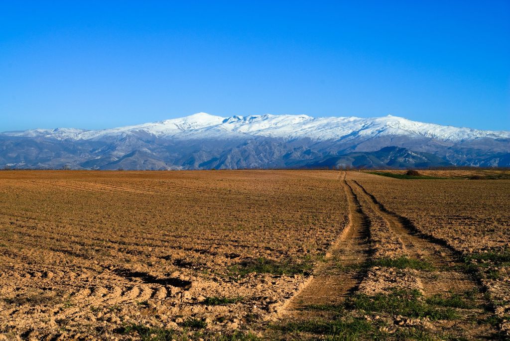
The beautiful Sierra Nevada. Cr. Wikimedia Commons: Antonio Morales García

Mulhacén Peak . Cr. Explore-share. com
South of the Meseta
The Sierra Morena (La Sierra Morena), stretches for 1476ft (450km) from east to west across the south of the Iberian Peninsula, forming the southern border of the Meseta Central plateau and providing the watershed between the valleys of the Guadiana to the north and the west, and the Guadalquivir to the south.
The Sierra Morena has a diverse landscape of rugged peaks to gentle slopes, cascading waterfalls to ancient olive groves. Beneath the lush vegetation lies a fascinating geological history. Ancient rocks such as granite, quartzite, and slate dominate, weathering into distinctive formations. Mineral deposits have long attracted humans, with mining for silver, lead, copper, and mercury leaving a historical imprint on the region like in the UNESCO Global Geopark: Sierra Norte National Park.

The Iron Mountains in the Sierra Norte National Park.
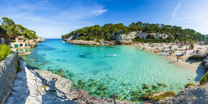
Area 2: The Balearic Islands / Las Islas Baleares
The balearic islands are an archipelago in the western Mediterranean Sea, near the eastern coast of the Iberian Peninsula. The main islands of the autonomous community are Majorca (Mallorca), Menorca (Menorca), Ibiza (Ibiza), and Formentera, all popular tourist destinations. Amongst the minor islands is Cabrera, Es Conills, Es Vedrà, Sa Conillera, Dragonera, S’Espalmador, S’Espardell, Ses Bledes, Santa Eulària, Plana, Foradada, Tagomago, Na Redona, Colom, L’Aire, etc.
The Balearic Islands province has the longest coastline of any provinces in Spain, with a length of coastline 1,428 kilometres.

Cr. Holiday Home Lets
Mallorca:
Cr. kimkim. com
Menorca:

Ibiza:

Cr.roughguides.com
Formentera:

Cr. travelandleisure.com
Area 3: The Canary Islands / Las Islas Canarias
The Canary Islands are a Spanish autonomous community and archipelago in Macaronesia in the Atlantic Ocean. At their closest point to the African mainland, they are 62 mi (100 km) west of Morocco and the Western Sahara. They are the southernmost of the autonomous communities of Spain.
The seven main islands are (from largest to smallest in area) Tenerife, Fuerteventura, Gran Canaria, Lanzarote, La Palma, La Gomera, and El Hierro. The archipelago includes many smaller islands and islets, including La Graciosa, Alegranza, Isla de Lobos, Montaña Clara, Roque del Oeste, and Roque del Este.
In 2019, the Canary Islands had a population of 2,153,389, with a density of 287.39 inhabitants per km2, making it the eighth most populous autonomous community of Spain. The population is mostly concentrated in the two capital islands: around 43% on the island of Tenerife and 40% on the island of Gran Canaria.
Cr. Research Gate

Cr. Wikimedia Commons (Oona Räisänen (Mysid)
Tenerife:
Cr. orangebus. com

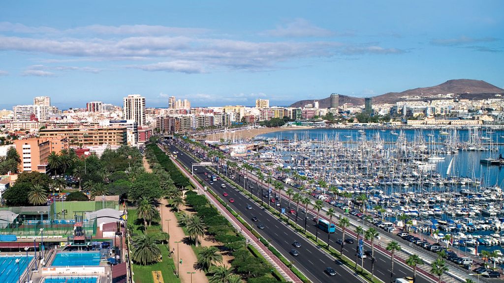
Gran Canarias: Las Palmas
Area 4: Ceuta, Melilla, Islas Chafarinas, Peñón de Vélez de la Gomera, Peñon de Alhucemas & Isla de Alborán.
All of these locations are located in Morocco or near it facing the Mediterranean Sea.

Ceuta:
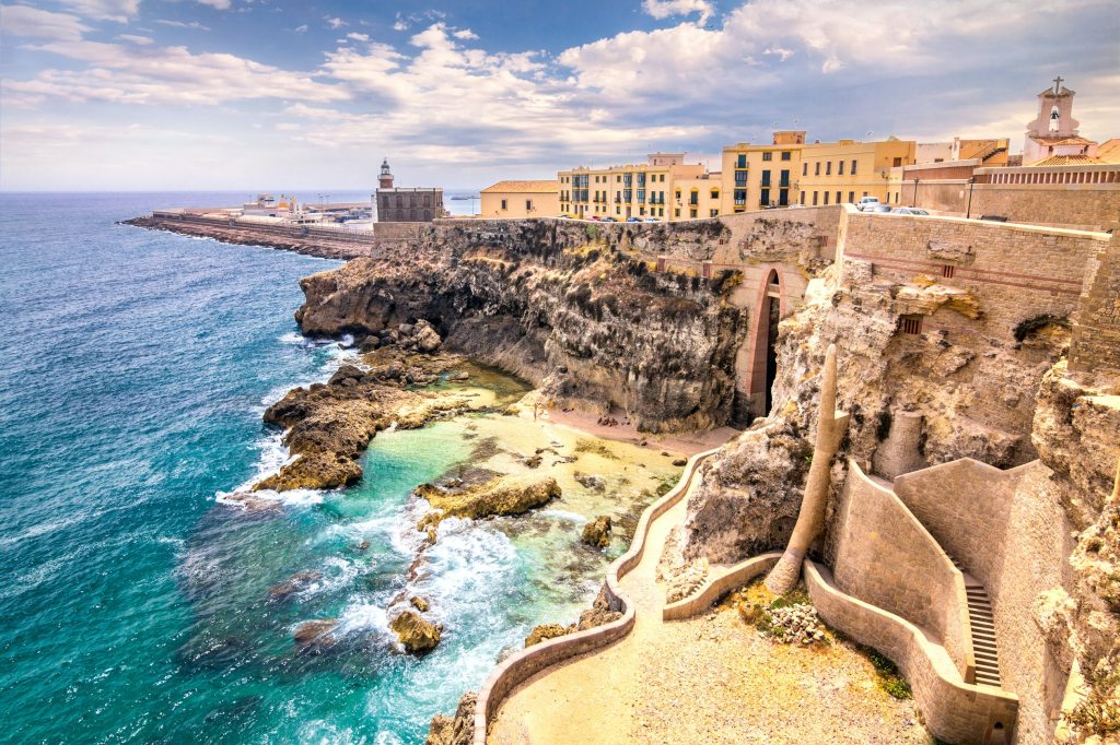
Ceuta is an autonomous city of Spain on the north coast of Africa bordered by Morocco. It lies along the boundary between the Mediterranean Sea and the Atlantic Ocean. Ceuta is one of the special member state territories of the European Union and it is one of several Spanish territories in Africa, along with Melilla and the Canary Islands, one of only a few that are permanently inhabited by a civilian population. It was a regular municipality belonging to the province of Cádiz prior to the passing of its Statute of Autonomy in March 1995, as provided by the Spanish Constitution, henceforth becoming an autonomous city.


Ceuta seen from The Mirador of Isabella II. Cr. Wikimedia Commons, Mario Sánchez Bueno
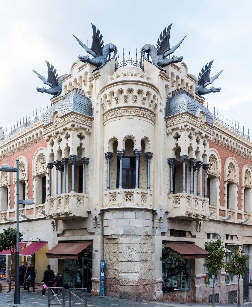
The House of Dragons, built in 1905. Cr. Wikimedia Commons, Diego Delso
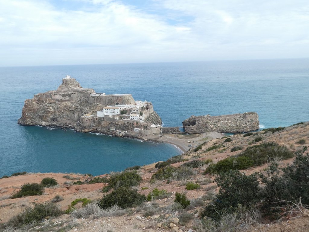
Melilla:
Melilla is an autonomous city of Spain in North Africa. It lies on the eastern side of the Cape Three Forks, bordering Morocco and facing the Mediterranean Sea. It has an area of 12.3 km2 (4.7 sq mi). It was part of the Province of Málaga until 14 March 1995, when the Statute of Autonomy of Melilla was passed.
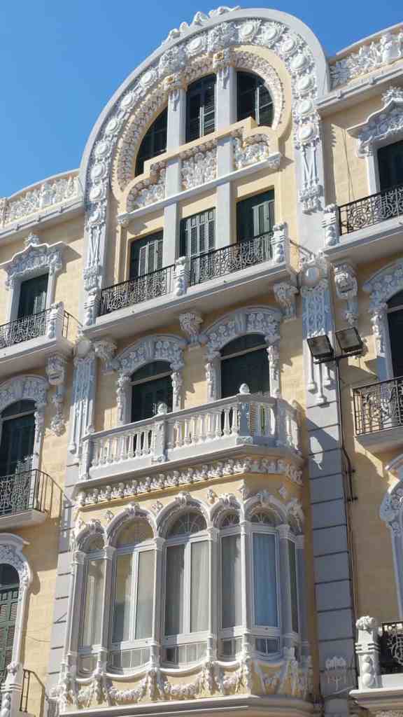
The city has been Spanish since 1497, long before the surrounding area became part of Morocco or before the state of Morocco was created. Spain has rejected all demands from Morocco to acquire it. Melilla has an old city center with an huge fortress known as “Melilla La Vieja.” It is known for its beautifu Modernista or Art Nouveau Architecture created by a pupil of Antonio Gaudí called Enrique Nieto.

Cr. Wikimedia Commons
Cr. thetravel. com
Cr. paulinaontheroad. com
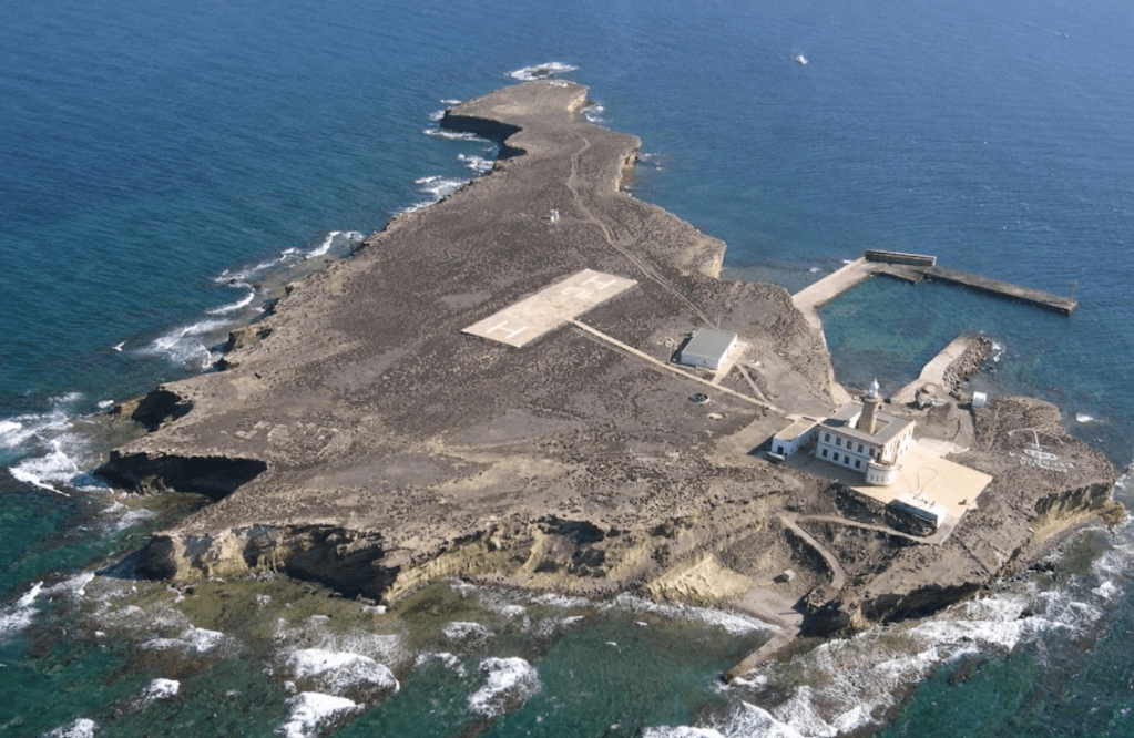
The Chafarinas Islands
The Chafarinas Islands are made up of three islands (from west to east, with areas in hectares):
- Isla del Congreso (25.6 ha)
- Isla de Isabel II (15.3 ha) (with garrison)
- Isla del Rey (11.6 ha).
Under Spanish control since 1847, there is a 30-man military garrison on Isla Isabel II, the only stable population on the small archipelago, down from 426 people in 1900 and 736 people in 1910. Small numbers of scientists, anti-trafficking police, and other authorized personnel sometimes increase the population to around 50.
Cr. getlstd
Peñón de Vélez de la Gomera:
is a Spanish exclave and rocky tidal island, in the western Mediterranean Sea, connected to the Moroccan shore by a sandy isthmus. It is also connected to a smaller islet to the east, La Isleta, by a rocky isthmus. The tidal island was named Hajar Badis (Rock of Badis) and was connected to the town of Badis.
Peñón de Vélez de la Gomera is located 73.94 mi (119 km) southeast of Ceuta. It was a natural island in the Alboran Sea until 1930, when a huge thunderstorm washed large quantities of sand into the short channel between the island and the African continent. The channel was turned into a tombolo and the island became a peninsula, connected to the Moroccan coast by an 85 m (278.87 ft) long sandy isthmus, which is the world’s shortest single land-border segment.
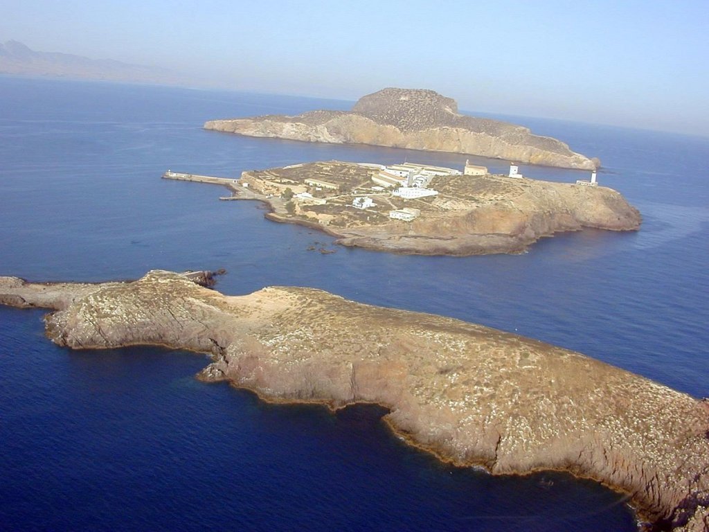
Peñón de Alhucemas:
Peñón de Alhucemas, together with the islets of Isla de Mar and Isla de Tierra slightly to the west, form the Alhucemas Islands. They are located 300 metres (984 feet) off the Moroccan town of Al Hoceima, or Alhucemas (former Villa Sanjurjo), 146 km (91 miles) east of Ceuta and 84 km (52 miles) west of Melilla. The aggregate land area of the group of three islands is 0.018 sq mi (4.6 ha or 0.046 square km.)

Cr. El Faro
Spanish rule dates back to 1559, when the Saadis ceded several territories to Spain in exchange for Spanish help against Ottoman armies. In 1673, Spain sent a garrison to the island of Peñón de Alhucemas, and has permanently occupied it since then.

Cr. Andalucía Travel
Isla de Alborán
Cr. Jose Manuel Carou Álvarez
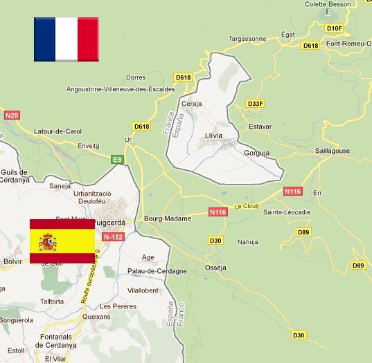
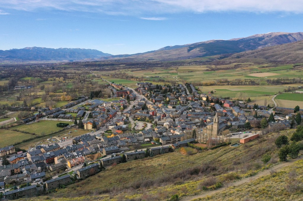
Llívia
Llivia is a town in the comarca of Cerdanya, province of Girona, Catalonia, Spain. It is a Spanish exclave surrounded by the French département of Pyrénées-Orientales. The small town is connected to Spain’s main land through a road that is 1 mile (1.6 km) that includes the French communes of Ur and Bourg-Madam. The Segre-Rever, a tributary of the Spanish Ebro, flows through Llívia. In 2018, the municipality of Llívia had a total population of 1,428.
Originally named Julia Livia, it was a thriving Roman settlement and later served as the capital of the Cerdanya region. Traces of its Roman heritage can be found in the town’s layout and archaeological sites.
In 1659, after a long war, France and Spain agreed to make the Pyrenees mountains their border. This meant most of the Cerdanya region went to France, except for one little town – Llívia! Why? Because the treaty said only villages could be handed over, and Llívia, being an important town (even the old capital!), stayed Spanish. So, Llívia became a tiny island of Spain surrounded by France.
Cr. mapsontheweb.zoom-maps. com
Cr. letrainjaune. fr
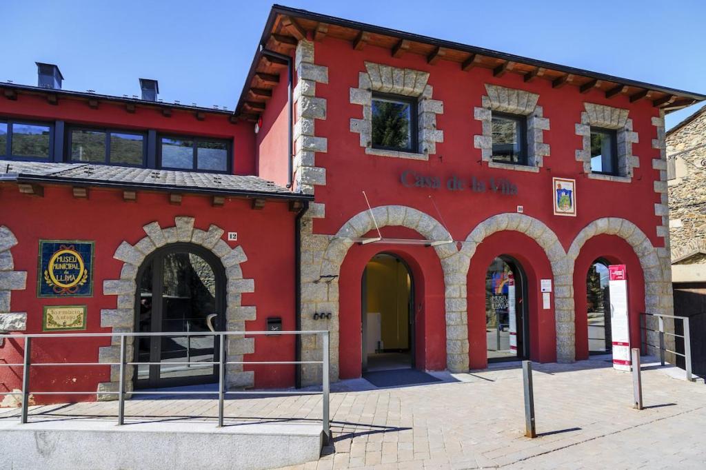
The Esteve Pharmacy, located in Llívia’s municipal museum, is a complete 18th-century pharmacy donated to the town by the family who owned it, on condition the contents remain in the town. There are records of pharmacists practicing in Llívia since medieval times. The pharmacy has a large display of Albarelli, a type of ceramic jar used in pharmacies, as well as antique drugs, and one of the most important collections of prescription books in Europe.
Cr. http://www.visitpirineus. com
This is a funny (to me) historic fact: ”The ‘War’ of the Stop Signs.”
Main Rivers
There are two major depressions in the peninsula that is part of Spain, that of the Ebro River in the northeast and that of the Guadalquivir River in the southwest.
Río Ebro
The Ebro, rising in Cantabria, is Spain’s longest river within its territory (the Tajo is the longest in the entire peninsula), flowing 565 miles (910 km) to its delta on the Mediterranean, near Tarragona.

Cr. tripadvisor
Río Guadalquivir
Flowing 408 miles (657 km) from Jaén’s mountains to the Atlantic, the Guadalquivir ranks among Spain’s longest rivers. Its basin, renowned for its biodiversity, covers 22,318 square miles. The river’s fertile plains and engineered capabilities support Andalusia’s agriculture and industries, making it a vital artery of life and progress.
Cr. fascinatingspain .com/
Rio Duero
Born in Spain’s misty Sierra de Urbión, the Duero river is Iberia’s 3rd longest river carving a 556-mile path westward. Draining over 30,000 sq mi, it sculpts canyons through the Numantian Plateau before gracing Portugal’s vine-clad terraces, birthplace of famed Port wine. Finally, at Foz do Douro, it surrenders to the Atlantic, leaving a legacy of fertile lands, rich history, and captivating beauty.

Cr. Wikimedia Commons: CGRM. Arribes del Duero, vistas desde la Presa de Aldeadávila (provincia de Salamanca, España).
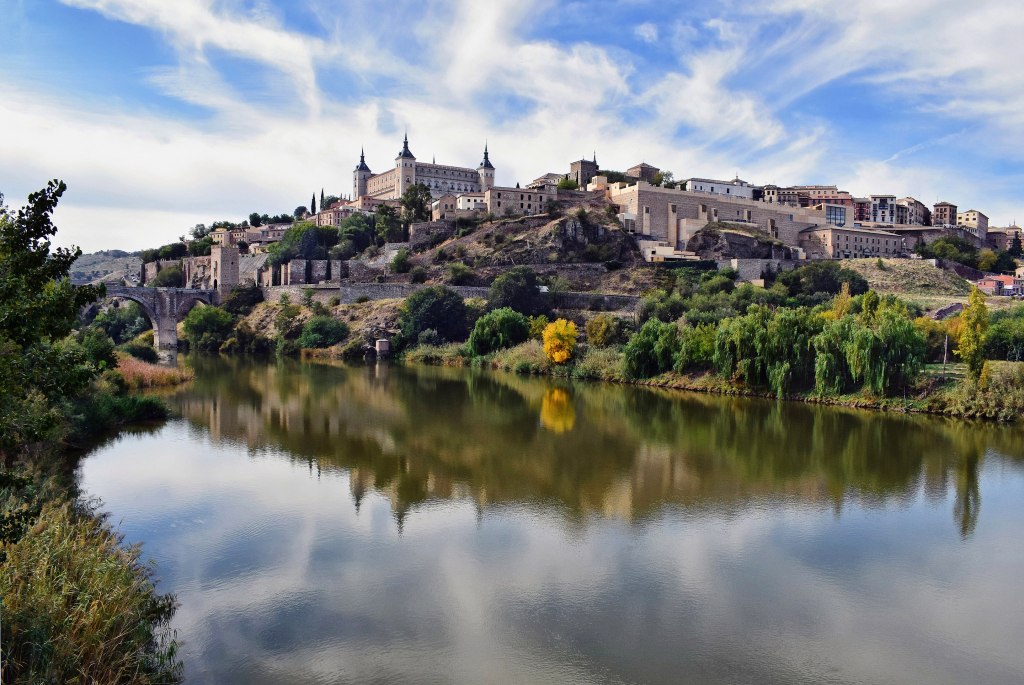
Rio Tajo
El río tajo, (the Tagus) is the longest river in the Iberian Peninsula. The river rises in the Montes Universales near Teruel, in mid-eastern Spain, flows 626 mi (1,007 km ), generally westward, and empties into the Atlantic Ocean in Lisbon.
Cr. Wikimedia Commons: Jocelyn Erskine-Kellie


